 INSPIRE Geoportal
Regione Toscana - Scuole Miur
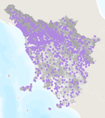
Localizzazione delle scuole del territorio della Regione Toscana
Simple
- Date (Revision)
- 2013
- Citation identifier
- r_toscan:2a4980a4-49be-4a0f-89d5-6fcf27c5f9cb
- Cited responsible party
-
Organisation name Individual name Electronic mail address Role Regione Toscana
urp@regione.tos urp@regione.toscana.it
Owner
- Presentation form
- Digital map
- Issue identification
-
r_toscan:2a4980a4-49be-4a0f-89d5-6fcf27c5f9cb
- Point of contact
-
Organisation name Individual name Electronic mail address Role Regione Toscana - Settore Sistema Informativo e Pianificazione del Territorio
contatto.cartografia@regione.tos contatto.cartografia@regione.toscana.it
Point of contact
- Keywords
-
-
EU
-
- Keywords
-
-
opendata
-
-
GEMET
-
-
ambiente urbano, stress urbano
-
aspetti sociali, popolazione
-
edificio
-
pianificazione edilizia
-
scienze sociali
-
scienze umane
-
sensibilizzazione del pubblico
-
sito d'interesse classificato
-
struttura edificata
-
- Use limitation
-
no conditions apply
- Access constraints
- Other restrictions
- Other constraints
- no limitations to public access
- Use constraints
- Other restrictions
- Other constraints
-
La risorsa è liberamente accessibile e usabile con licenza CC BY
- Spatial representation type
- Vector
- Denominator
- 10000
- Language
- Italiano
- Character set
- UTF8
- Topic category
-
- Planning cadastre
- Structure
))
- Supplemental Information
-
Cod.RT: 116 - ScuoleMiur - 2a4
- Unique resource identifier
- Monte-Mario-Italy1
- Distribution format
-
Name Version ESRI Shapefile
1.0
- Distributor contact
-
Organisation name Individual name Electronic mail address Role Regione Toscana - Settore Sistema Informativo e Pianificazione del Territorio
contatto.cartografia@regione.tos contatto.cartografia@regione.toscana.it
Distributor
- OnLine resource
-
Protocol Linkage Name WWW:LINK-1.0-http--link https://www502.regione.toscana.it/geoscopio/infrastrutturepresidi.html
- Hierarchy level
- Dataset
Quantitative result
- Value
- 2.5
Conformance result
- Date (Publication)
- 2010-12-08
- Explanation
-
Fare riferimento alle specifiche indicate
- Statement
-
Il dataset deriva da un elenco di edifici scolastici fornito dal MIUR. Tali elementi sono stati individuati e georeferenziati utilizzando anche la CTR 1:10000. Ai suddetti elementi è associata una tabella statistica, sempre fornita dal MIUR, che fornisce informazioni sulle caratteristiche delle singole unità.
Metadata
- File identifier
- r_toscan:2a4980a4-49be-4a0f-89d5-6fcf27c5f9cb XML
- Metadata language
- Italiano
- Character set
- UTF8
- Hierarchy level
- Dataset
- Date stamp
- 2022-10-20
- Metadata standard name
-
Linee Guida RNDT
- Metadata standard version
-
2.0
- Metadata author
-
Organisation name Individual name Electronic mail address Role Regione Toscana - Settore Sistema Informativo e Pianificazione del Territorio
contatto.cartografia@regione.tos contatto.cartografia@regione.toscana.it
Point of contact
Overviews
Spatial extent
Provided by
