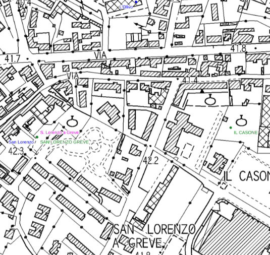
Regione Toscana - WFS REpertorio TOponomastico REgionale (RETORE)
Si tratta di un servizio OGC di tipo WFS fornito da Regione Toscana (Sistema Informativo e Pianificazione del Territorio) dedicato specificamente alla consultazione di dataset del Progetto RETORE: 'Repertorio Toponomastico Regionale'.
Simple
Identification info
- Date (Creation)
- 2011-12-31
- Citation identifier
- r_toscan:bd034059-ff69-4d30-b19b-14aac26f64d2
- Cited responsible party
-
Organisation name Individual name Electronic mail address Role Regione Toscana
urp@regione.tos urp@regione.toscana.it
Owner
- Issue identification
-
r_toscan:bd034059-ff69-4d30-b19b-14aac26f64d2
- Point of contact
-
Organisation name Individual name Electronic mail address Role Regione Toscana - Settore Sistema Informativo e Pianificazione del Territorio
contatto.cartografia@regione.tos contatto.cartografia@regione.toscana.it
Point of contact
-
REGOLAMENTO (CE) N. 1205/2008 DELLA COMMISSIONE del 3 dicembre 2008 recante attuazione della direttiva 2007/2/CE del Parlamento europeo e del Consiglio per quanto riguarda i metadati, Parte D 4, Classificazione dei servizi di dati territoriali
-
GEMET
-
-
thesaurus
-
- Keywords
-
-
EU
-
- Use limitation
-
Nessuna condizione applicabile
- Access constraints
- Other restrictions
- Other constraints
- no limitations to public access
- Use constraints
- Other restrictions
- Other constraints
-
Nessun Vincolo
- Service Type
- download
))
- Coupled Resource
-
Operation Name Scoped name Identifier GetCapabilities
Regione Toscana WFS RETORE r_toscan:b2eaaaad-6753-4470-a8c1-52f3e7ad8ba6
- Coupling Type
- Tight
- Contains Operations
-
Operation Name Distributed Computing Platforms Connect Point GetCapabilities
Web services https://www502.regione.toscana.it/ows2/com.rt.wms.RTmap/wms?map=owsretore&service=wfs&request=getcapabilities&versione=1.3.0
- Unique resource identifier
- RDN2008-TM32EN
- Distribution format
-
Name Version OGC:OWS Context
1.0
- OnLine resource
-
Protocol Linkage Name OGC:WFS
https://www502.regione.toscana.it/ows2/com.rt.wms.RTmap/wms?map=owsretore&service=wfs&request=getcapabilities&versione=1.3.0
- Hierarchy level
- Service
- Other
-
Service
Conformance result
- Date (Publication)
- 2010-12-08
- Explanation
-
Fare riferimento alle specifiche indicate
Metadata
- File identifier
- r_toscan:bd034059-ff69-4d30-b19b-14aac26f64d2 XML
- Metadata language
- Italiano
- Character set
- UTF8
- Hierarchy level
- Service
- Hierarchy level name
-
servizio
- Date stamp
- 2022-03-23
- Metadata standard name
-
Linee Guida RNDT
- Metadata standard version
-
2.0
- Metadata author
-
Organisation name Individual name Electronic mail address Role Regione Toscana - Settore Sistema Informativo e Pianificazione del Territorio
contatto.cartografia@regione.tos contatto.cartografia@regione.toscana.it
Point of contact
Overviews

Spatial extent
))
Provided by

 INSPIRE Geoportal