 INSPIRE Geoportal
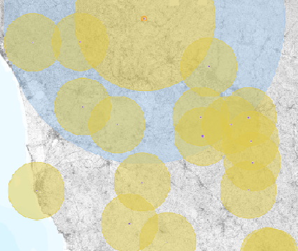
Regione Toscana - Inquinamento luminoso - Stazione Astronomiche e Zone di protezione della Toscana ai sensi della LR 39/2005 - DGR 903/2020
Misure di protezione dall'inquinamento Luminoso a favore delle stazioni astronomiche. Il database comprende l'elenco puntuale delle stazioni astronomiche di cui all'art. 34 della LR 39/2005 e delle aree di protezione di cui all'art. 35 commi 1,2 e 4 come individuate dalla delibera DGR 903/2020.
Simple
- Date (Creation)
- 2019-10-01
- Date (Publication)
- 2019-10-01
- Citation identifier
- r_toscan:3e40b8d5-d29a-4d4e-937f-a360433d9e8c
- Cited responsible party
-
Organisation name Individual name Electronic mail address Role Regione Toscana
urp@regione.tos urp@regione.toscana.it
Owner Regione Toscana - Servizi Pubblici Locali, Energia e Inquinamenti
luigi.giardina@regione.tos luigi.giardina@regione.toscana.it
Principal investigator
- Presentation form
- Digital map
- Issue identification
-
r_toscan:3e40b8d5-d29a-4d4e-937f-a360433d9e8c
- Point of contact
-
Organisation name Individual name Electronic mail address Role Regione Toscana - Settore Sistema Informativo e Pianificazione del Territorio
contatto.cartografia@regione.tos contatto.cartografia@regione.toscana.it
Point of contact Regione Toscana - Servizi Pubblici Locali, Energia e Inquinamenti
Regione Toscana - Servizi Pubblici Locali, Energia e Inquinamenti
Point of contact
- Keywords
-
-
EU
-
- Keywords
-
-
opendata
-
-
GEMET
-
-
inquinamento
-
- Use limitation
-
no conditions apply
- Access constraints
- Other restrictions
- Other constraints
- no limitations to public access
- Use constraints
- Other restrictions
- Other constraints
-
La risorsa è liberamente accessibile e usabile con licenza CC BY
- Spatial representation type
- Vector
- Denominator
- 10000
- Language
- Italiano
- Character set
- UTF8
- Topic category
-
- Imagery base maps earth cover
- Environment
- Planning cadastre
))
- Supplemental Information
-
Cod.RT:109 - InqLumZone - bf6
- Unique resource identifier
- Monte-Mario-Italy1
- Distribution format
-
Name Version ESRI Shapefile
1.0
- Distributor contact
-
Organisation name Individual name Electronic mail address Role Regione Toscana - Settore Sistema Informativo e Pianificazione del Territorio
contatto.cartografia@regione.tos contatto.cartografia@regione.toscana.it
Distributor
- OnLine resource
-
Protocol Linkage Name WWW:LINK-1.0-http--link https://www502.regione.toscana.it/geoscopio/inquinamentoluminoso.html
- Hierarchy level
- Dataset
Quantitative result
- Value
- 2.5
Conformance result
- Date (Publication)
- 2010-12-08
- Explanation
-
Fare riferimento alle specifiche indicate
- Statement
-
Il dato e' stato ricavato localizzando sulle mappe regionali CTR 10K gli elenchi delle stazioni astronomiche di cui alla DGR 903/2020
Metadata
- File identifier
- r_toscan:bf662f88-16fc-4864-9501-3993be114a0a XML
- Metadata language
- Italiano
- Character set
- UTF8
- Hierarchy level
- Dataset
- Date stamp
- 2022-11-07
- Metadata standard name
-
Linee Guida RNDT
- Metadata standard version
-
2.0
- Metadata author
-
Organisation name Individual name Electronic mail address Role Regione Toscana - Settore Sistema Informativo e Pianificazione del Territorio
contatto.cartografia@regione.tos contatto.cartografia@regione.toscana.it
Point of contact Regione Toscana - Servizi Pubblici Locali, Energia e Inquinamenti
luigi.giardina@regione.tos luigi.giardina@regione.toscana.it
Point of contact
Overviews
Spatial extent
Provided by
