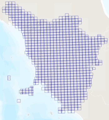
Regione Toscana - Ortofoto volo GAI 1954-1956
Ortofoto a copertura dell'intero territorio regionale realizzata con i fotogrammi del volo GAI degli anni 1954 1955 1956
Simple
- Date (Creation)
- 2021-01-01
- Citation identifier
- r_toscan:e0eb1209-974a-471e-be1b-0c9921cce7ad
- Cited responsible party
-
Organisation name Individual name Electronic mail address Role Regione Toscana
urp@regione.tos urp@regione.toscana.it
Owner
- Presentation form
- Digital image
- Issue identification
-
r_toscan:e0eb1209-974a-471e-be1b-0c9921cce7ad
- Point of contact
-
Organisation name Individual name Electronic mail address Role Regione Toscana - Settore Sistema Informativo e Pianificazione del Territorio
contatto.cartografia@regione.tos contatto.cartografia@regione.toscana.it
Point of contact
-
GEMET - INSPIRE themes, version 1.0
-
-
Orto immagini
-
- Keywords
-
-
EU
-
ortofoto
-
-
GEMET
-
-
fotografia aerea (immagine)
-
- Keywords
-
-
opendata
-
- Access constraints
- Other restrictions
- Other constraints
- no limitations to public access
- Use constraints
- Other restrictions
- Other constraints
-
La risorsa è liberamente accessibile e usabile con licenza CC BY
- Use limitation
-
Nessuna condizione applicabile
- Spatial representation type
- Grid
- Denominator
- 10000
- Language
- Italiano
- Character set
- UTF8
- Topic category
-
- Imagery base maps earth cover
- Farming
- Environment
- Planning cadastre
))
- Begin date
- 1954-01-01
- End date
- 1956-12-31
- Supplemental Information
-
Cod.RT: 80 - OrtoGai - e0e
- Reference system identifier
- Monte-Mario-Italy1
- Number of dimensions
- 2
- Dimension name
- Row
- Dimension size
- 6200
- Resolution
- 1 http://standards.iso.org/iso/19139/resources/uom/ML_gmxUom.xml#m
- Dimension name
- Column
- Dimension size
- 7400
- Resolution
- 1 http://standards.iso.org/iso/19139/resources/uom/ML_gmxUom.xml#m
- Cell geometry
- Area
- Transformation parameter availability
- No
- Checkpoint Availability
- No
- Checkpoint Description
-
I Check Points hanno le medesime caratteristiche dei GCP relativamente a distribuzione e posizionamento, la lorodislocazione è complementare a quella dei GCP
- Point in Pixel
-
- Upper left
- Distribution format
-
Name Version TIFF
1.0
- Distributor contact
-
Organisation name Individual name Electronic mail address Role Regione Toscana - Settore Sistema Informativo e Pianificazione del Territorio
contatto.cartografia@regione.tos contatto.cartografia@regione.toscana.it
Distributor
- OnLine resource
-
Protocol Linkage Name WWW:LINK-1.0-http--link https://www502.regione.toscana.it/geoscopio/ortofoto.html
- Hierarchy level
- Dataset
Quantitative result
- Value
- 5
Conformance result
- Date (Publication)
- 2010-12-08
- Explanation
-
non valutato
- Statement
-
Ortofoto realizzata con i fotogrammi del volo GAI eseguito sull'intero territorio della Regione Toscana negli anni 1954-1956
- Attribute description
- Valore pancromatico del pixel nello spettro del visibile
- Content type
- Image
- Bits per value
- 8
- Triangulation indicator
- No
Metadata
- File identifier
- r_toscan:e0eb1209-974a-471e-be1b-0c9921cce7ad XML
- Metadata language
- Italiano
- Character set
- UTF8
- Hierarchy level
- Dataset
- Date stamp
- 2023-09-26
- Metadata standard name
-
Linee Guida RNDT
- Metadata standard version
-
2.0
- Metadata author
-
Organisation name Individual name Electronic mail address Role Regione Toscana - Settore Sistema Informativo e Pianificazione del Territorio
contatto.cartografia@regione.tos contatto.cartografia@regione.toscana.it
Point of contact
Overviews

Spatial extent
))
Provided by

 INSPIRE Geoportal