 INSPIRE Geoportal
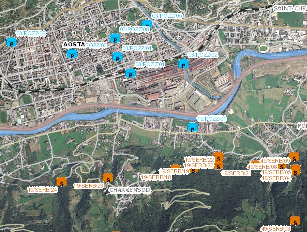
Sistema Idrico Integrato - Acquedotti - Serbatoi
Censimento BIM di 1° livello dei serbatoi della rete acquedottistica eseguito nel 2011.
Simple
- Date (Creation)
- 2016-07
- Date (Publication)
- 2016-07
- Date (Revision)
- 2021-11
- Citation identifier
- r_vda:00338-DATA
- Cited responsible party
-
Organisation name Individual name Electronic mail address Role Regione Autonoma Valle d'Aosta
u-cartografia@regione.vda.it cartografia@regione.vda u-cartografia@regione.vda.it
Owner Consorzio BIM VDA - Ente di Governo d'ambito
info@bimvda.it info@bimvda.it; protocollo@pec.bimvda.it protocollo@pec.bim info@bimvda.it; protocollo@pec.bimvda.it
Author
- Presentation form
- Digital map
- Issue identification
-
r_vda:00338-DATA
- Point of contact
-
Organisation name Individual name Electronic mail address Role RAVDA - Ufficio cartografico
u-cartografia@regione.vda.it cartografia@regione.vda u-cartografia@regione.vda.it
Point of contact
- Maintenance and update frequency
- As needed
- GEMET - Concepts, version 2.4
-
-
acquedotto
-
- Keywords
-
-
mappa_privata
-
EU
-
- Use limitation
-
Nel rispetto del diritto di proprietà e di autore propri dell'Amministrazione regionale, legge n.633 del 22 aprile 1941, protezione del diritto d'autore e di altri diritti connessi al suo esercizio è vietata, sotto qualsiasi forma, la duplicazione, la riproduzione, la commercializzazione e/o la cessione a terzi dei dati ceduti, anche se parzialmente rielaborati.
- Access constraints
- Other restrictions
- Other constraints
- Nessuna Limitazione al Pubblico Accesso
- Use constraints
- Other restrictions
- Other constraints
- Nessuna Condizione di Accesso e Utilizzo
- Spatial representation type
- Vector
- Denominator
- 1000
- Distance
- 1 http://standards.iso.org/ittf/PubliclyAvailableStandards/ISO_19139_Schemas/resources/uom/ML_gmxUom.xml#m
- Language
- Italiano
- Character set
- UTF8
- Topic category
-
- Utilities communication
- Structure
))
- Begin date
- 2016-07-12
- End date
- 2030-12-31
Vertical extent
- Minimum value
- 340
- Maximum value
- 3480
- Supplemental Information
-
Server: GDB: SIIFeature dataset: BIMFeature class: Pozzi_SIIFeature Type: SimpleGeometry Type: LineAttributi:- Codice- Comune- Denominazione
- Unique resource identifier
- ED50-UTM32N
- Distribution format
-
Name Version geo+json 1.0
- Distributor contact
-
Organisation name Individual name Electronic mail address Role Ufficio Cartografico - Centro Diffusione Conoscenze Territoriali
u-cartografia@regione.vda.it cartografia@regione.vda u-cartografia@regione.vda.it
Distributor
- OnLine resource
-
Protocol Linkage Name WWW:LINK-1.0-http--link http://geonavsct.partout.it/pa/GeoNavSCTpa/index.html?metadato=MTD151N0020
- Hierarchy level
- Dataset
Quantitative result
- Value
- 10.00
Conformance result
- Date (Publication)
- 2010-12-08
- Explanation
-
Fare riferimento alle specifiche indicate
- Statement
-
Censimento BIM di 1° livello dei serbatoi della rete acquedottistica eseguito nel 2013.
Metadata
- File identifier
- r_vda:00338-META:20160908:170937 XML
- Metadata language
- Italiano
- Character set
- UTF8
- Parent identifier
-
Sistema Idrico Integrato - Acquedotti - Serbatoi
r_vda:00338-META:20160908:170937
- Hierarchy level
- Dataset
- Hierarchy level name
-
Dataset
- Date stamp
- 2016-07-12
- Metadata standard name
- Linee Guida RNDT
- Metadata standard version
-
2.0
- Metadata author
-
Organisation name Individual name Electronic mail address Role RAVDA - Ufficio Cartografico
u-cartografia@regione.vda.it cartografia@regione.vda u-cartografia@regione.vda.it
Point of contact
Overviews
Spatial extent
Provided by
