 INSPIRE Geoportal
Catasto ghiacciai - Ghiacciai lunghezza
Dato lineare, lunghezza del ghiacciaio calcolata come linea che unisce la quota massima e la quota minima lungo una linea di flusso del ghiacciaio. SCOPO:Diffusione di dati sui ghiacciai del territorio regionale.
Simple
- Date (Creation)
- 2011-07-29
- Date (Revision)
- 2023-01-12
- Citation identifier
- r_vda:01322-DATA
- Cited responsible party
-
Organisation name Individual name Electronic mail address Role Regione Autonoma Valle d'Aosta
u-cartografia@regione.vda.it cartografia@regione.vda u-cartografia@regione.vda.it
Owner Fondazione Montagna Sicura
Author RAVDA - Assetto idrogeologico dei bacini montani
u-valanghe@regione.vda.it valanghe@regione.vda u-valanghe@regione.vda.it
Point of contact
- Presentation form
- Digital map
- Issue identification
-
r_vda:01322-DATA
- Point of contact
-
Organisation name Individual name Electronic mail address Role RAVDA - Ufficio Cartografico
u-cartografia@regione.vda.it cartografia@regione.vda u-cartografia@regione.vda.it
Point of contact
- Maintenance and update frequency
- As needed
- Keywords
-
-
EU
-
- Use limitation
-
Nel rispetto del diritto di proprietà e di autore propri dell'Amministrazione regionale, legge n.633 del 22 aprile 1941, Protezione del diritto d'autore e di altri diritti connessi al suo esercizio, è vietata, sotto qualsiasi forma, la duplicazione, e/o riproduzione sotto qualsiasi forma, la commercializzazione e/o la cessione a terzi dei dati ceduti, anche se parzialmente rielaborati.
- Access constraints
- Other restrictions
- Other constraints
- Nessuna Limitazione al Pubblico Accesso
- Access constraints
- Other restrictions
- Other constraints
- Nessuna Condizione di Accesso e Utilizzo
- Spatial representation type
- Vector
- Denominator
- 10000
- Distance
- 1 http://standards.iso.org/ittf/PubliclyAvailableStandards/ISO_19139_Schemas/resources/uom/ML_gmxUom.xml#m
- Language
- Italiano
- Character set
- UTF8
- Topic category
-
- Inland waters
- Environment
- Geoscientific information
))
- Begin date
- 2012-01-01
- End date
- 2030-12-31
Vertical extent
- Minimum value
- 1450
- Maximum value
- 4800
- Supplemental Information
-
Server: GDB: CatastoGhiacciaiFeature dataset: /Feature class: Lunghezze_2005Attributi:- CODICE WGI- NOME GHIACCIAIO- NOME BACINO- ANNO- QUOTA MINIMA- QUOTA MASSIMA- LUNGHEZZA
- Unique resource identifier
- ED50-UTM32N
- Distribution format
-
Name Version geo+json 1.0
- Distributor contact
-
Organisation name Individual name Electronic mail address Role Ufficio Cartografico - Centro Diffusione Conoscenze Territoriali
u-cartografia@regione.vda.it cartografia@regione.vda u-cartografia@regione.vda.it
Distributor
- OnLine resource
-
Protocol Linkage Name WWW:LINK-1.0-http--link https://mappe.partout.it/pub/GeoNavSCT/?metadato=MTD25N2502
- Hierarchy level
- Dataset
Quantitative result
- Value
- 1.00
Conformance result
- Date (Publication)
- 2010-12-08
- Explanation
-
Fare riferimento alle specifiche indicate
- Statement
-
Fotointerpretazione di ortofoto (volo 2005/06), rilievi sul terreno.
Metadata
- File identifier
- r_vda:01322-META:20160908:170943 XML
- Metadata language
- Italiano
- Character set
- UTF8
- Parent identifier
-
Catasto ghiacciai - Ghiacciai lunghezza
r_vda:01322-META:20160908:170943
- Hierarchy level
- Dataset
- Hierarchy level name
-
Dataset
- Date stamp
- 2023-01-12
- Metadata standard name
- Linee Guida RNDT
- Metadata standard version
-
2.0
- Metadata author
-
Organisation name Individual name Electronic mail address Role RAVDA
u-cartografia@regione.vda.it cartografia@regione.vda u-cartografia@regione.vda.it
Point of contact
Overviews
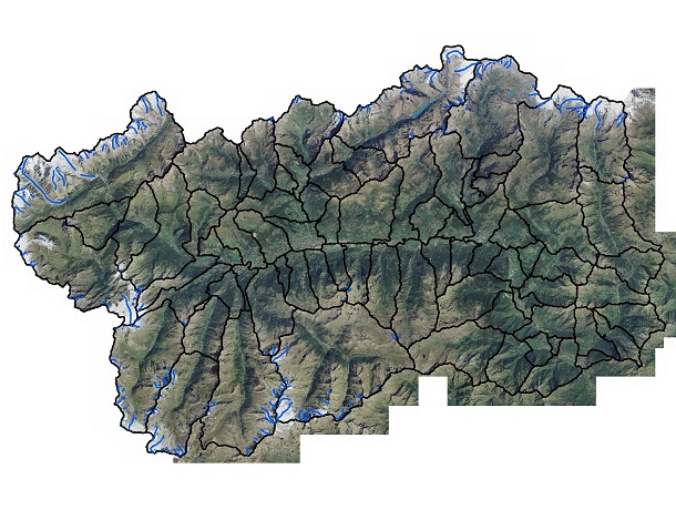
Spatial extent
Provided by
