 INSPIRE Geoportal
PsInSAR RADARSAT
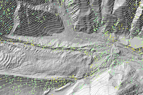
Contiene dati radar satellitari elaborati con tecnica interferometrica e modalità SqueeSAR, relativi a tutto il territorio regionale per il periodo 2003-2010. SCOPO: Rendere patrimonio comune le informazioni su dati di spostamento della superficie topografica relativi a tutto il territorio regionale.
Simple
- Date (Creation)
- 2003-01-01
- Date (Publication)
- 2012-03-19
- Date (Revision)
- 2023-04-14
- Citation identifier
- r_vda:01464-DATA
- Cited responsible party
-
Organisation name Individual name Electronic mail address Role Regione Autonoma Valle d'Aosta
u-cartografia@regione.vda.it cartografia@regione.vda u-cartografia@regione.vda.it
Owner RAVDA - Attività geologiche
s-geologico@regione.vda.it geologico@regione.vda s-geologico@regione.vda.it
Author
- Presentation form
- Digital map
- Issue identification
-
r_vda:01464-DATA
- Point of contact
-
Organisation name Individual name Electronic mail address Role RAVDA - Assessorato opere pubbliche, difesa del suolo e edilizia residenziale pubblica
m.broccolato@regione.vda m.broccolato@regione.vda.it
Point of contact
- Maintenance and update frequency
- Not planned
- GEMET - Concepts, version 2.4
-
-
immagine da satellite
-
- Keywords
-
-
mappa_privata
-
EU
-
- Access constraints
- Other restrictions
- Other constraints
- Nessuna Limitazione al Pubblico Accesso
- Use constraints
- Other restrictions
- Other constraints
-
Può essere visualizzata solo la disposizione spaziale dei punti ma non possono essere consultati i metadati.
- Spatial representation type
- Vector
- Denominator
- 1000
- Language
- Italiano
- Character set
- UTF8
- Topic category
-
- Location
))
- Begin date
- 2012-01-01
- End date
- 2030-12-31
Vertical extent
- Minimum value
- 292
- Maximum value
- 4191
- Supplemental Information
-
GDB:PS-InSARFeature Dataset: ERSFeature Class:BRUSSON_R7_RSAT_S3_A_T290_VALDAOSTA_UTM32_ED50_2011_TSRFeature Type:SimpleGeometry Type:PointAttributi:CODEHEIGHTH_STDEVVELV_STDEVCOHERENCEEFF_AREA
- Unique resource identifier
- ED50-UTM32N
- Distribution format
-
Name Version geo+json Shape
- Distributor contact
-
Organisation name Individual name Electronic mail address Role RAVDA
m.broccolato@regione.vda m.broccolato@regione.vda.it
Distributor
- OnLine resource
-
Protocol Linkage Name WWW:LINK-1.0-http--link http://geologiavda.partout.it/progettoPSInSAR?l=it
- Hierarchy level
- Dataset
Quantitative result
- Value
- 1
Conformance result
- Date (Publication)
- 2010-12-08
- Explanation
-
Fare riferimento alle specifiche indicate
- Statement
-
I dati radar satellitari sono stati elaborati con tecnica interferometrica e modalità SqueeSAR. Sono relativi a tutto il territorio regionale e si riferiscono al periodo 2003-2010.
Metadata
- File identifier
- r_vda:01464-META:20160908:170944 XML
- Metadata language
- Italiano
- Character set
- UTF8
- Parent identifier
-
PsInSAR RADARSAT
r_vda:01464-META:20160908:170944
- Hierarchy level
- Dataset
- Hierarchy level name
-
Dataset
- Date stamp
- 2012-03-19
- Metadata standard name
- Linee Guida RNDT
- Metadata standard version
-
2.0
- Metadata author
-
Organisation name Individual name Electronic mail address Role RAVDA
u-cartografia@regione.vda.it cartografia@regione.vda u-cartografia@regione.vda.it
Point of contact
Overviews
Spatial extent
Provided by
