INSPIRE Geoportal
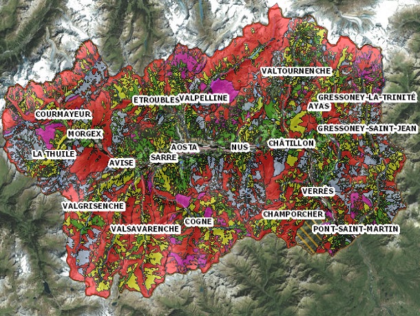
Ambiti inedificabili art.35 comma 1 - Frane
Ambiti inedificabili legge regionale 11/98 art.35 comma 1. SCOPO: Individuare quelle aree in cui gli interventi edilizi o trasformativi sono vietati o regolamentati, ai sensi delle norme contenute al Titolo V, Capo I della L.R. 11/98.
Simple
- Date (Creation)
- 2011-07-04
- Date (Revision)
- 2016-10
- Citation identifier
- r_vda:02963-DATA
- Cited responsible party
-
Organisation name Individual name Electronic mail address Role Regione Autonoma Valle d'Aosta
Owner RAVDA - Ufficio coordinamento piani e ambiti inedificabili
Author
- Presentation form
- Digital map
- Issue identification
-
r_vda:02963-DATA
- Point of contact
-
Organisation name Individual name Electronic mail address Role RAVDA - Ufficio Cartografico
Point of contact
- Maintenance and update frequency
- As needed
-
Alto rischio idrogeologico
-
-
F1
-
F2
-
F3
-
- Keywords
-
-
EU
-
- Access constraints
- Other restrictions
- Other constraints
- Nessuna Limitazione al Pubblico Accesso
- Use constraints
- Other restrictions
- Other constraints
-
https://sct-outil.regione.vda.it/SCTProfessional/static/pdf/CC_BY_Repertorio_SCT_Outil_v3.pdf
- Spatial representation type
- Vector
- Denominator
- 10000
- Distance
- 1 m
- Language
- Italiano
- Character set
- UTF8
- Topic category
-
- Environment
- Planning cadastre
))
- Begin date
- 2012-01-01
- End date
- 2030-12-31
Vertical extent
- Minimum value
- 300
- Maximum value
- 4000
- Unique resource identifier
- ED50-UTM32N
- Distribution format
-
Name Version geo+json 1.0
- Distributor contact
-
Organisation name Individual name Electronic mail address Role Ufficio Cartografico - Centro Diffusione Conoscenze Territoriali
Distributor
- OnLine resource
-
Protocol Linkage Name WWW:LINK-1.0-http--link https://mappe.partout.it/pub/GeoNavSCT/?metadato=MTD16N2197
- OnLine resource
-
Protocol Linkage Name Web Map Service (WMS) https://geoservizi.regione.vda.it/geoserver/sctAmbiti/wms?service=WMS&version=1.1.0&request=GetCapabilities
- Hierarchy level
- Dataset
Quantitative result
- Value
- 1.00
Conformance result
- Date (Publication)
- 2010-12-08
- Explanation
-
Fare riferimento alle specifiche indicate
- Statement
-
La cartografia è stata realizzata sulla CTRN in scala 1:5000 e/o 1:10000.Il dato è stato approvato dalla Giunta Regionale.
Metadata
- File identifier
- r_vda:02963-META:20161020:171000 XML
- Metadata language
- Italiano
- Character set
- UTF8
- Parent identifier
-
Ambiti inedificabili art.35 comma 1 - Frane
r_vda:02963-META:20161020:171000
- Hierarchy level
- Dataset
- Hierarchy level name
-
Dataset
- Date stamp
- 2023-01-11
- Metadata standard name
- Linee Guida RNDT
- Metadata standard version
-
2.0
- Metadata author
-
Organisation name Individual name Electronic mail address Role RAVDA - Ufficio Cartografico
Point of contact