 INSPIRE Geoportal
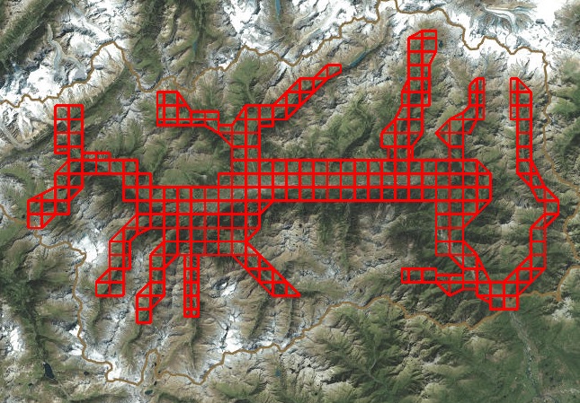
Quadri di Unione - Ortofoto 2005 scala 5000
Tavole dell'ortofoto dell'anno 2005 in scala 1:5000.
Simple
- Date (Creation)
- 2017-05-01
- Date (Publication)
- 2017-05-01
- Date (Revision)
- 2022-01-27
- Citation identifier
- r_vda:03412-DATA
- Cited responsible party
-
Organisation name Individual name Electronic mail address Role Regione Autonoma Valle d'Aosta
u-cartografia@regione.vda.it cartografia@regione.vda u-cartografia@regione.vda.it
Owner
- Presentation form
- Digital map
- Issue identification
-
r_vda:03412-DATA
- Point of contact
-
Organisation name Individual name Electronic mail address Role RAVDA - Ufficio cartografico
u-cartografia@regione.vda.it cartografia@regione.vda u-cartografia@regione.vda.it
Point of contact
- Maintenance and update frequency
- Not planned
- Keywords
-
-
EU
-
- Use limitation
-
Nel rispetto del diritto di proprietà e di autore propri dell'Amministrazione regionale, legge n.633 del 22 aprile 1941, protezione del diritto d'autore e di altri diritti connessi al suo esercizio è vietata, sotto qualsiasi forma, la duplicazione, la riproduzione, la commercializzazione e/o la cessione a terzi dei dati ceduti, anche se parzialmente rielaborati.
- Access constraints
- Other restrictions
- Other constraints
- Nessuna Limitazione al Pubblico Accesso
- Use constraints
- Other restrictions
- Other constraints
-
Nessuno.
- Spatial representation type
- Vector
- Denominator
- 25000
- Distance
- 1 http://standards.iso.org/ittf/PubliclyAvailableStandards/ISO_19139_Schemas/resources/uom/ML_gmxUom.xml#m
- Language
- Italiano
- Character set
- UTF8
- Topic category
-
- Imagery base maps earth cover
))
- Begin date
- 2016-07-12
- End date
- 2030-12-31
Vertical extent
- Minimum value
- 340
- Maximum value
- 3480
- Supplemental Information
-
Server: GDB: QDUFeature Dataset: CTRN_ORTOFOTOFeature class: Qdu_ortofoto_2005_5000
- Unique resource identifier
- ED50-UTM32N
- Distribution format
-
Name Version geo+json 1.0
- Distributor contact
-
Organisation name Individual name Electronic mail address Role Ufficio Cartografico - Centro Diffusione Conoscenze Territoriali
u-cartografia@regione.vda.it cartografia@regione.vda u-cartografia@regione.vda.it
Distributor
- OnLine resource
-
Protocol Linkage Name WWW:LINK-1.0-http--link https://mappe.partout.it/pub/GeoNavSCT/index.html?metadato=MTD113N0020
- OnLine resource
-
Protocol Linkage Name Web Map Service (WMS) https://geoservizi.regione.vda.it/geoserver/sctQdu/wms?service=WMS&version=1.1.0&request=GetCapabilities
- Hierarchy level
- Dataset
Quantitative result
- Value
- 1.00
Conformance result
- Date (Publication)
- 2010-12-08
- Explanation
-
Fare riferimento alle specifiche indicate
- Statement
-
Tavole dell'ortofoto dell'anno 2005 in scala 1:5000.
Metadata
- File identifier
- r_vda:03412-META:20170519:104500 XML
- Metadata language
- Italiano
- Character set
- UTF8
- Parent identifier
-
Quadri di Unione - Ortofoto 2005 scala 5000
r_vda:03412-META:20170519:104500
- Hierarchy level
- Dataset
- Hierarchy level name
-
Dataset
- Date stamp
- 2022-01-27
- Metadata standard name
- Linee Guida RNDT
- Metadata standard version
-
2.0
- Metadata author
-
Organisation name Individual name Electronic mail address Role RAVDARAVDA - Ufficio Cartografico
u-cartografia@regione.vda.it cartografia@regione.vda u-cartografia@regione.vda.it
Point of contact
Overviews
Spatial extent
Provided by
