 INSPIRE Geoportal
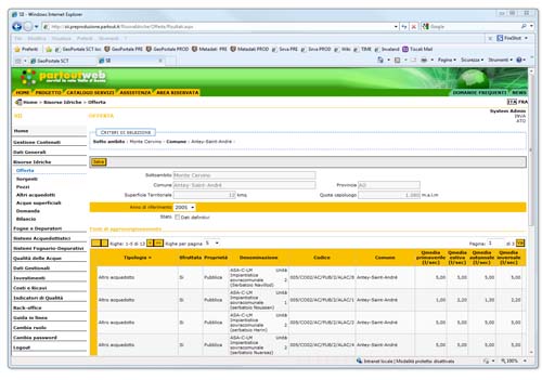
Applicazione - Sistema Idrico Integrato (SII)
L’applicazione web Servizio Idrico Integrato (SII), condiviso tra Regione, BIM, ARPA, USL e Enti Locali, gestisce le risorse idriche regionali, in conformità con la Legge Regionale 27/1999.SII è raggiungibile solo in seguito all'autenticazione al sistema Partout, di un utente abilitato a operare all'interno dell'applicativo.
Simple
Identification info
- Date (Creation)
- 2016-10-24
- Date (Publication)
- 2016-10-24
- Citation identifier
- r_vda:03566-SRV
- Cited responsible party
-
Organisation name Individual name Electronic mail address Role Regione Autonoma Valle d'Aosta
difesa_suolo@regione.vda.it suolo@regione.vda difesa_suolo@regione.vda.it
Owner RAVDA - Dipartimento programmazione, risorse idriche e territorio
difesa_suolo@regione.vda.it suolo@regione.vda difesa_suolo@regione.vda.it
Author
- Point of contact
-
Organisation name Individual name Electronic mail address Role RAVDA - Ufficio Cartografico
u-cartografia@regione.vda.it cartografia@regione.vda u-cartografia@regione.vda.it
Point of contact
-
REGOLAMENTO (CE) N. 1205/2008 DELLA COMMISSIONE del 3 dicembre 2008 recante attuazione della direttiva 2007/2/CE del Parlamento europeo e del Consiglio per quanto riguarda i metadati, Parte D 4, Classificazione dei servizi di dati territoriali
- Keywords
-
-
applicazione_privata
-
EU
-
- Access constraints
- Other restrictions
- Other constraints
- Nessuna Limitazione al Pubblico Accesso
- Access constraints
- Other restrictions
- Other constraints
-
Utenza accreditata
- Service Type
- view
))
- Coupling Type
- Loose
- Contains Operations
-
Operation Name Distributed Computing Platforms Connect Point GetMap
Web services http://sii.partout.it/
- Unique resource identifier
- ETRS89-XYZ
- OnLine resource
-
Protocol Linkage Name http://sii.partout.it/
- Hierarchy level
- Service
- Other
-
Service
Conformance result
- Date (Publication)
- 2010-12-08
- Explanation
-
Fare riferimento alle specifiche indicate
Metadata
- File identifier
- r_vda:03566-META:20171020:100200 XML
- Metadata language
- Italiano
- Character set
- UTF8
- Parent identifier
-
Applicazione - Sistema Idrico Integrato (SII)
r_vda:03566-META:20171020:100200
- Hierarchy level
- Service
- Hierarchy level name
-
Servizio
- Date stamp
- 2016-10-24
- Metadata standard name
- Linee Guida RNDT
- Metadata standard version
-
2.0
- Metadata author
-
Organisation name Individual name Electronic mail address Role RAVDA - Ufficio cartografico
u-cartografia@regione.vda.it cartografia@regione.vda u-cartografia@regione.vda.it
Point of contact
Overviews
Spatial extent
Provided by
