 INSPIRE Geoportal
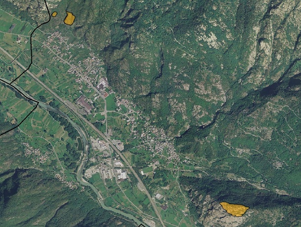
Piano Regolatore - M2 Strutture geologiche sorgenti minerarie siti di interesse mineralogico petrografico geomorfologico
Piano Regolatore Generale Comunale. Tavola M2. Indica gli elementi riportati nell'appendice 3 - Siti di interesse geologico - della relazione del PTP e altri eventualmente individuati dal Comune. SCOPO:Evidenziare e riconoscere i beni e le aree di interesse geologico, partendo da quelli individuati dal PTP.
Simple
- Date (Creation)
- 2018-10-15
- Date (Publication)
- 2018-10-15
- Citation identifier
- r_vda:03726-DATA
- Cited responsible party
-
Organisation name Individual name Electronic mail address Role Regione Autonoma Valle d'Aosta
u-cartografia@regione.vda.it cartografia@regione.vda u-cartografia@regione.vda.it
Owner RAVDA - Pianificazione territoriale
pianificazione_territoriale@regione.vda.it territoriale@regione.vda pianificazione_territoriale@regione.vda.it
Author
- Presentation form
- Digital map
- Issue identification
-
r_vda:03726-DATA
- Point of contact
-
Organisation name Individual name Electronic mail address Role RAVDA - Ufficio Cartografico
u-cartografia@regione.vda.it cartografia@regione.vda u-cartografia@regione.vda.it
Point of contact
- Maintenance and update frequency
- As needed
-
Piano Regolatore Generale Comunale
-
-
PRG
-
M2
-
- Keywords
-
-
EU
-
- Use limitation
-
Nel rispetto del diritto di proprietà e di autore propri dell'Amministrazione regionale, legge n.633 del 22 aprile 1941, Protezione del diritto d'autore e di altri diritti connessi al suo esercizio, è vietata, sotto qualsiasi forma, la duplicazione, e/o riproduzione, la commercializzazione e/o la cessione a terzi dei dati ceduti, anche se parzialmente rielaborati.
- Access constraints
- Other restrictions
- Other constraints
- Nessuna Limitazione al Pubblico Accesso
- Use constraints
- Other restrictions
- Other constraints
- Nessuna Condizione di Accesso e Utilizzo
- Spatial representation type
- Vector
- Denominator
- 2000
- Distance
- 1 http://standards.iso.org/ittf/PubliclyAvailableStandards/ISO_19139_Schemas/resources/uom/ML_gmxUom.xml#m
- Language
- Italiano
- Character set
- UTF8
- Topic category
-
- Planning cadastre
))
- Begin date
- 2018-10-15
- End date
- 2030-12-31
Vertical extent
- Minimum value
- 320
- Maximum value
- 4810
- Supplemental Information
-
Server: GDB: _PRGC_Merge.gdbFeature dataset: M2_Analisi_dei_valori_naturalisticiFeatureclass: M2_Siti_GeologFeature Type: SimpleGeometry Type: PolygonAttributi:- COMUNE- TIPO- NUMERO DGR- NUMERO DCC- DATA DGR- DATA DCC- VARIANTE
- Unique resource identifier
- ED50-UTM32N
- Distribution format
-
Name Version geo+json 1.0
- Distributor contact
-
Organisation name Individual name Electronic mail address Role Ufficio Cartografico - Centro Diffusione Conoscenze Territoriali
u-cartografia@regione.vda.it cartografia@regione.vda u-cartografia@regione.vda.it
Distributor
- OnLine resource
-
Protocol Linkage Name WWW:LINK-1.0-http--link https://mappe.partout.it/pub/GeoNavSCT/?metadato=MTD37N2545
- Hierarchy level
- Dataset
Quantitative result
- Value
- 0.02
Conformance result
- Date (Publication)
- 2010-12-08
- Explanation
-
Fare riferimento alle specifiche indicate
- Statement
-
La cartografia è stata realizzata sulla Base Catastale del professionista.
Metadata
- File identifier
- r_vda:03726-META:20181015:092000 XML
- Metadata language
- Italiano
- Character set
- UTF8
- Parent identifier
-
Piano Regolatore - M2 Strutture geologiche sorgenti minerarie siti di interesse mineralogico petrografico geomorfologico
r_vda:03726-META:20181015:092000
- Hierarchy level
- Dataset
- Hierarchy level name
-
Dataset
- Date stamp
- 2018-10-15
- Metadata standard name
- Linee Guida RNDT
- Metadata standard version
-
2.0
- Metadata author
-
Organisation name Individual name Electronic mail address Role RAVDA - Ufficio Cartografico
u-cartografia@regione.vda.it cartografia@regione.vda u-cartografia@regione.vda.it
Point of contact
Overviews
Spatial extent
Provided by
