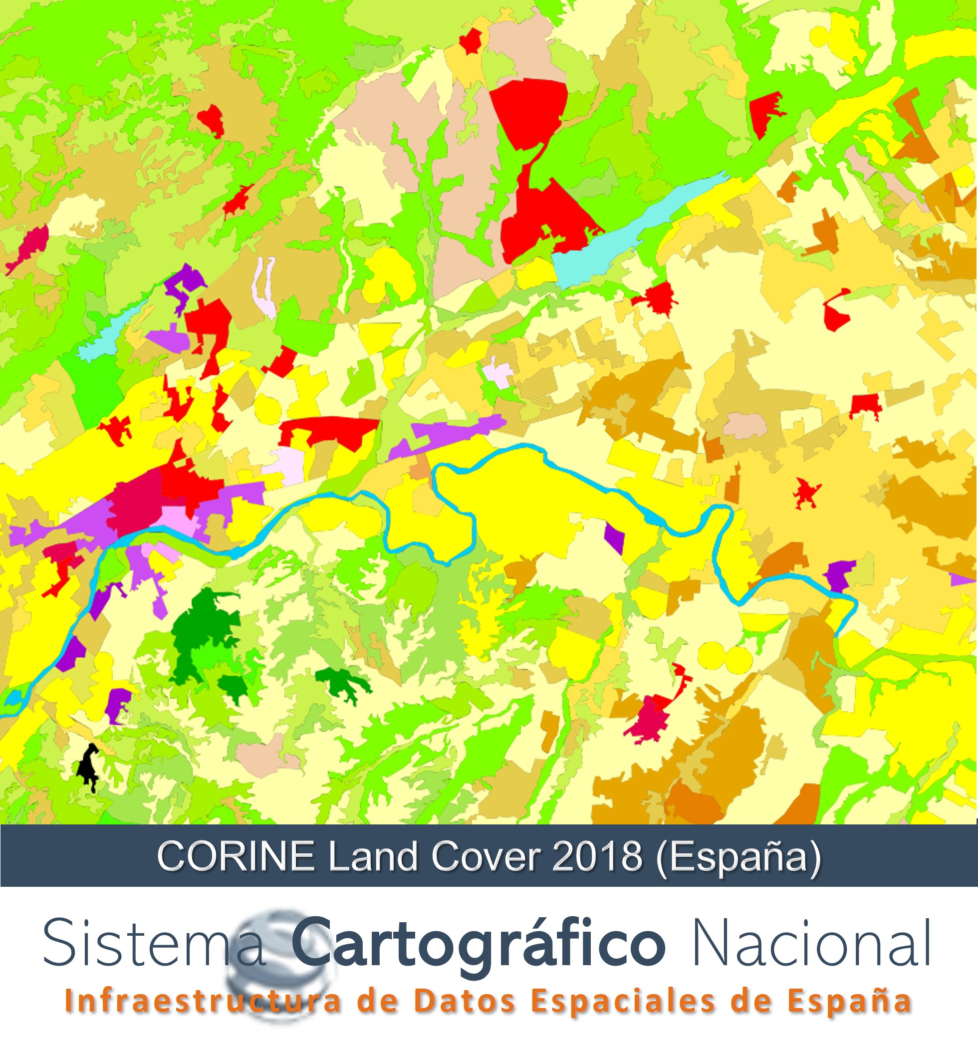
CORINE Land Cover 2018 (Spain)
Land cover map of Spain corresponding to the European CORINE Land Cover (CLC) project with a nomenclature of 44 classes, version of the reference year 2018.
Simple
- Alternate title
-
CLC2018 (Spain)
- Date (Creation)
- 2018-09-01
- Date (Publication)
- 2019-10-01
- Citation identifier
- SCNE / LCLU
- Citation identifier
- SCNE / LC.LandCoverSurfaces
- Presentation form
- Digital map
- Purpose
-
European database at a scale of 1:100,000 to satisfy the needs of the General State Administration and the Autonomous Communities in terms of land occupation, as well as those of the European Union, avoiding duplication of data.
- Credit
-
Producto creado por la colaboración de: Instituto Geográfico Nacional (IGN España) - Centro Nacional de Información Geográfica (CNIG) - Comunidades Autónomas - Agencia Europea de Medio Ambiente - Comisión Europea
- Status
- Completed
- Point of contact
-
Organisation name Individual name Electronic mail address Role National Geographic Institute
Point of contact Center National of Geographic Information (CNIG)
Publisher European Commission
Point of contact National Centre of Geographic Information (CNIG)
Publisher
- Keywords
-
-
IGN
-
- Keywords
-
-
Sistema Cartográfico Nacional
-
- Specific usage
-
El CORINE Land Cover (CLC) es una base de datos europea de Ocupación del Suelo perteneciente al programa «GMES» (Global Monitoring for Environment and Security) de la «Comisión Europea», una iniciativa de la Unión Europea para desarrollar su propia capacidad operativa de observación de la Tierra. Es una herramienta fundamental para el diseño de políticas de gestión territorial y medioambiental para Europa y muy útil también a nivel internacional, por ejemplo, proporcionando datos para el programa GEOSS (Global Earth Observation System of Systems) y facilitando datos esenciales para evaluar la absorción y emisión de gases de efecto invernadero para el Protocolo de Kioto, según se dicta en el Convenio Marco de Naciones Unidas sobre Cambio Climático.
- User contact info
-
Organisation name Individual name Electronic mail address Role Agencia Europea del Medio Ambiente
Owner Spanish National Geographic Institute
Owner National Centre of Geographic Information (CNIG)
Resource provider National Geographic Institute
User
- Access constraints
- Other restrictions
- Other constraints
- Sin limitaciones al acceso público.
- Use constraints
- Other restrictions
- Other constraints
- CC BY 4.0
- Spatial representation type
- Vector
- Denominator
- 100000
- Language
- Spanish; Castilian
- Character set
- UTF8
- Topic category
-
- Imagery base maps earth cover
- Description
-
Península Ibérica, Illes Balears, Islas Canarias, Ceuta y Melilla
))
Vertical extent
- Minimum value
- 0
- Maximum value
- 3718
- Supplemental Information
-
https://centrodedescargas.cnig.es/CentroDescargas/documentos/CLC_documentacion_auxiliar.zip
- Unique resource identifier
- ETRS89 UTM huso 30 extendido en la Península, Illes Balears, Ceuta y Melilla.
- Unique resource identifier
- REGCAN95 UTM huso 28 en las Islas Canarias.
- Distribution format
-
Name Version Geodatabase (.gdb) 10.3
GeoPackage 2.0
gml+xml a través de servicio WFS. 3.2
Distributor
- Distributor contact
-
Organisation name Individual name Electronic mail address Role Centro Nacional de Información Geográfica (CNIG)
Distributor
Distributor
- Distributor contact
-
Organisation name Individual name Electronic mail address Role European Environment Agency
Distributor
- Fees
-
Free download through the CNIG's download centre or through network services of INSPIRE Directive
- Units of distribution
-
Whole of Spain and GML files for queries through WFS.
- OnLine resource
-
Protocol Linkage Name OGC Web Map Service https://servicios.idee.es/wms-inspire/ocupacion-suelo?REQUEST=GetCapabilities&SERVICE=WMS&VERSION=1.3.0 View Services (WMS) for Land Cover of Spain
OGC Web Feature Service https://servicios.idee.es/wfs-inspire/ocupacion-suelo?REQUEST=GetCapabilities&SERVICE=WFS&VERSION=2.0.0 Download Services (WFS) for Land Cover of Spain
OGC Web Map Tile Service https://servicios.idee.es/wmts/ocupacion-suelo?REQUEST=GetCapabilities&SERVICE=WMTS&VERSION=1.0.0 View Services (WMTS) for Land Cover of Spain
https://centrodedescargas.cnig.es/CentroDescargas/busquedaSerie.do?codSerie=02113 Download portal of CNIG
- Hierarchy level
- Dataset
Conformance result
Conformance result
- Statement
-
CORINE Land Cover 2018 se obtuvo mediante fotointerpretación sobre imágenes de satélite Sentinel 2, Landsat en falso color (combinación de bandas 453)y Spot como referencia básica del proyecto, utilizándose como apoyo otras bases de datos geográficas, como mapas topográficos o temáticos relativos a la ocupación del suelo y ortofotografías aéreas, así como otra información exógena de apoyo a la fotointerpretación. La producción se produjo de manera coordinada entre diferentes organismos públicos.
Sobre las imágenes se delimitaron áreas o zonas susceptibles de representar una unidad de ocupación del suelo según CORINE Land Cover, asociando a cada zona una clase de nomenclatura CLC y extendiendo esta delimitación a un conjunto de zonas de la imagen que presentaran características similares, consiguiendo una base de datos continua para todo el territorio
Process step
Metadata
- File identifier
- spaignCLC2018 XML
- Metadata language
- Spanish; Castilian
- Character set
- UTF8
- Hierarchy level
- Dataset
- Date stamp
- 2024-07-23
- Metadata standard name
-
INSPIRE Regulation Nº1205/2008
- Metadata standard version
-
TG 2.0
- Metadata author
-
Organisation name Individual name Electronic mail address Role Spanish Spatial Data Infrastructure (IDEE)
Point of contact
- Other language
-
Language Character encoding English UTF8
 INSPIRE Geoportal

