 INSPIRE Geoportal
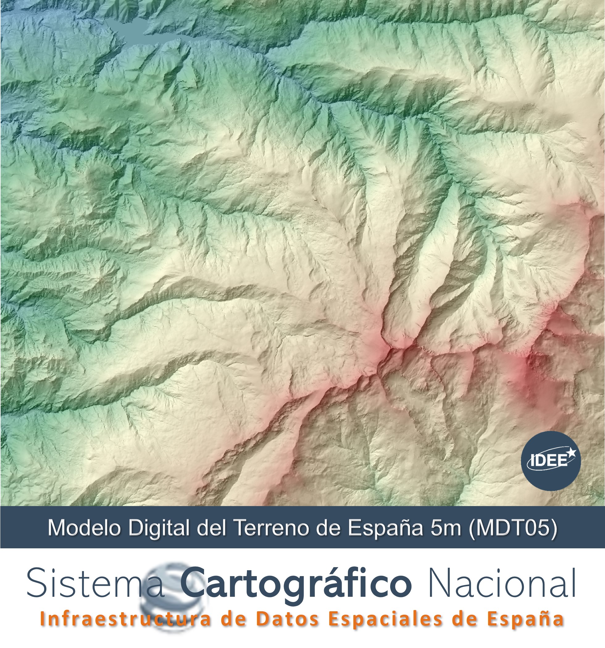
Digital Terrain Model - DTM05 of Spain
Digital terrain model made from the LIDAR point clouds of the first Cover with a mesh pitch of 5 meters.
Simple
- Alternate title
-
MDT05
- Date (Creation)
- 2009-12-30
- Citation identifier
- IGN / MDT05
- Citation identifier
- IGN / EL.SpotElevation
- Citation identifier
- IGN / EL.ContourLine
- Citation identifier
- IGN / EL.ElevationGridCoverage
- Presentation form
- Digital model
- Purpose
-
The DTMs are necessary to generate the orthophotos of the PNOA Project and to have a homogeneous and accurate digital elevation model for the whole Spanish territory.
- Credit
-
Comunidades Autónomas
- Credit
-
FEGA.
- Credit
-
Sistema Cartográfico Nacional
- Credit
-
Instituto Geográfico Nacional
- Point of contact
-
Organisation name Individual name Electronic mail address Role National Geographic Institute
Point of contact Centro Nacional de Información Geográfica (CNIG)
Publisher
- Keywords
- Keywords
-
-
Relieve
-
- Keywords
-
-
Sistema Cartográfico Nacional
-
- Keywords
-
-
SCNE
-
- Specific usage
-
Para estudios de zonas de inundación, para determinación de obstáculos en las rutas de aproximación de los aeropuertos, para la generación de las ortofotos del Proyecto PNOA
- User contact info
-
Organisation name Individual name Electronic mail address Role Centro de Estudios y Experimentación de Obras Públicas
User National Geographic Institute
User
- Access constraints
- Other restrictions
- Other constraints
- Sin limitaciones al acceso público.
- Use constraints
- Other restrictions
- Other constraints
- MDT05 CC BY 4.0 SCNE
- Spatial representation type
- Grid
- Distance
- 5 metros
- Language
- Spanish; Castilian
- Character set
- UTF8
- Topic category
-
- Elevation
- Description
-
Península Ibérica, Illes Balears, Islas Canarias, Ceuta y Melilla
))
Vertical extent
- Minimum value
- -100
- Maximum value
- 3718
- Supplemental Information
-
https://centrodedescargas.cnig.es/CentroDescargas/documentos/MDT05_recursos.zip
- Unique resource identifier
- ETRS89 UTM huso 30 extendido en la Península, Illes Balears, Ceuta y Melilla.
- Unique resource identifier
- REGCAN95 UTM huso 28 en Canarias.
- Number of dimensions
- 2
Axis Dimensions Properties
- Cell geometry
- Area
- Transformation parameter availability
- No
- Distribution format
-
Name Version Cloud Optimized GeoTIFF, COG
unknown
Distributor
- Distributor contact
-
Organisation name Individual name Electronic mail address Role National Centre of Geographic Information (CNIG)
Distributor
- Units of distribution
-
MTN50 Sheets
- OnLine resource
- Hierarchy level
- Series
Conformance result
Conformance result
- Statement
-
The DTM has been obtained by interpolation of digital terrain models of 5 m grid pitch from the interpolation from the terrain class of LIDAR flights of the PNOA, with the exception of the sheets of Andorra, Ceuta, Melilla, Isla de Alborán and Gibraltar (183-2, 1110-3, 1111-3, 1078B, 1078-2) obtained by automatic stereocorrelation of photogrammetric flights of the National Aerial Orthophotography Plan (PNOA).
Process step
- Description
-
Plan Nacional de Ortofotografía Aérea (PNOA)
Metadata
- File identifier
- spaignMDT05 XML
- Metadata language
- Spanish; Castilian
- Character set
- UTF8
- Hierarchy level
- Dataset
- Date stamp
- 2025-02-14
- Metadata standard name
-
INSPIRE Regulation Nº1205/2008
- Metadata standard version
-
TG 2.0
- Metadata author
-
Organisation name Individual name Electronic mail address Role Spanish Spatial Data Infrastructure (IDEE)
Point of contact
- Other language
-
Language Character encoding English UTF8
