 INSPIRE Geoportal
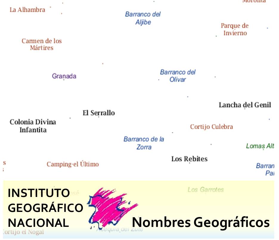
Basic Gazetteer of Spain
Database with the list of geographical names with their corresponding coordinates and other attributes from the debugging of the toponyms previously extracted from the projects BTN, and which constitutes the Basic Gazetteer of Spain, called NGBE.
Simple
-
Date (Creation)
- 2010-01-01
-
Date (Publication)
- 2010-01-01
- Edition
-
1ª Edición del WMS y WFS
-
Citation identifier
- IGN / NGBE
-
Citation identifier
- IGN / ngbe_nombres-geograficos
-
Presentation form
-
Digital document
-
Presentation form
-
Digital table
-
Purpose
-
The purpose of the Basic Gazetteer of Spain is to include all the official georeferenced denominations on topographical cartography at scales of 1:25,000 and below, both in Spanish and in the corresponding co-official languages. It is part of the National Geographic Reference Equipment
- Credit
-
Instituto Geográfico Nacional
- Point of contact
-
Organisation name Individual name Electronic mail address Role National Geographic Institute
OwnerNational Centre of Geographic Information (CNIG)
Publisher
-
Maintenance and update frequency
-
Monthly
-
Update scope
-
Dataset
- Maintenance note
-
Actualización mensual
- Keywords
-
-
IGN
-
CNIG
-
España
-
Toponimia
-
Nomenclátor
-
-
Specific usage
-
Search and location of geographical entities. Geographically referenced official names to be used in the official cartography.
- User contact info
-
Organisation name Individual name Electronic mail address Role National Geographic Institute
Author
-
Access constraints
-
Other restrictions
- Other constraints
- Sin limitaciones al acceso público.
-
Use constraints
-
Other restrictions
- Other constraints
- No se aplican condiciones de acceso y uso.
- Other constraints
- CC BY 4.0
-
Spatial representation type
-
Text, table
-
Denominator
- 25000
-
Language
- Spanish; Castilian
-
Language
- Catalan; Valencian
-
Language
- baq
-
Language
- glg
-
Character set
-
UTF8
-
Topic category
-
-
Location
-
- Description
-
Península Ibérica, Illes Balears, Islas Canarias, Ceuta y Melilla
))
- Supplemental Information
-
https://centrodedescargas.cnig.es/CentroDescargas/documentos/Memoria_NGBE.pdf
- Unique resource identifier
- ETRS89 UTM huso 29 en la parte oeste correspondiente de la península.
- Unique resource identifier
- ETRS89 UTM huso 30 en la Península, Ceuta y Melilla.
- Unique resource identifier
- ETRS89 UTM huso 31 en Illes Balears y la parte este correspondiente de la Península.
- Unique resource identifier
- REGCAN95 UTM Huso 28 en las Islas Canarias.
- Unique resource identifier
- ETRS89 en la Península, Illes Balears, Ceuta y Melilla. Coordenadas geográficas longitud y latitud.
- Unique resource identifier
- REGCAN95 en las Islas Canarias. Coordenadas geográficas longitud y latitud.
- Distribution format
-
Name Version CSV Desconocido
gml+xml a través de servicio WFS y ATOM 4.0
geo+json a través de API Features 1.0.2
Distributor
- Distributor contact
-
Organisation name Individual name Electronic mail address Role National Centre of Geographic Information (CNIG)
Distributor
-
Fees
-
Free download through the CNIG's download centre or through network services of INSPIRE Directive (WFS, ATOM Feed, API Features)
-
Units of distribution
-
Whole Spain
- OnLine resource
-
Protocol Linkage Name OGC Web Map Service https://www.ign.es/wms-inspire/ngbe?REQUEST=GetCapabilities&SERVICE=WMS&VERSION=1.3.0 View Services (WMS) of Basic Gazetteer of Spain
OGC Web Feature Service https://www.ign.es/wfs-inspire/ngbe?REQUEST=GetCapabilities&SERVICE=WFS&VERSION=2.0.0 Download Services (WFS) of Basic Gazetteer of Spain
Atom Feed https://www.ign.es/atom/dataset_feeds/nomen_geo_bas.es.xml Download Services (ATOM Feed) of Basic Gazetteer of Spain
OGC API - Features - Part 1: Core https://api-features.ign.es/collections/namedplace API for downloading Basic Gazetteer of Spain (API-Features)
https://centrodedescargas.cnig.es/CentroDescargas/buscadorCatalogo.do?codFamilia=NGBES Download portal of CNIG
-
Hierarchy level
-
Dataset
Conformance result
Conformance result
-
Statement
-
In order to obtain the NGBE, we have started from the denominations extracted from the topographic cartography of the National Geographic Institute on a scale of 1:25,000, on which the following methodological criteria have been applied for its purification: 1.Previous general treatments, suppression of descriptive terms and development of abbreviations.2. Elimination of toponyms of foreign countries which, due to cartographic needs, are symbolised, but which do not fall within the geographical scope defined for the realisation of the NGBE.3.Elimination of duplicated toponyms in different registers. Given the cartographic origin of toponyms, these appear as many times as necessary for the correct identification of the cartographic element.4. Transformation of the original cartographic classification into a new classification developed for this project based on toponymic criteria.5.Verification of the geographical referencing of the toponyms, specifying their location according to the entity they identify. The location of the toponyms that comes from the existing positioning in the cartography, is governed by the correct legibility of the map. Sometimes this location does not unequivocally identify the geographical entity they are calling. The situation of the toponyms has been corrected so that they make precise reference to the geographical element they indicate.6. 7.Treatment of composite toponyms (independent registers aggregated by means of conjunctions or linguistic symbols).8.Assignment of the INE code to each toponymic register, considering eleven figures (corresponding to the ;Nucleus of Population level) for registers linked to entities contemplated in the National Statistics Institute (INE) and five figures (corresponding to the ;Municipality level) for the remaining toponyms)
Process step
-
Description
-
The sources used for the elaboration of this NGBE are: National Topographic Base, Registry of Local Entities of the Ministry of Finance and Public Administration, National, Regional and Natural Parks, State Airports, State Ports, Ministry of Agriculture, Food and Environment, Geodesic Vertices of the National Geographic Institute and official denominations through publication in the different Bulletins and Official Journals
-
Denominator
- 25000
- Alternate title
-
BTN
-
Date (Creation)
- 2006-01-01
- Cited responsible party
-
Organisation name Individual name Electronic mail address Role National Geographic Institute
Point of contact
Metadata
-
File identifier
- spaignNGBE XML
-
Metadata language
- Spanish; Castilian
-
Character set
-
UTF8
-
Hierarchy level
-
Dataset
-
Date stamp
- 2024-06-27
-
Metadata standard name
-
INSPIRE Regulation Nº1205/2008
- Metadata standard version
-
TG 2.0
- Metadata author
-
Organisation name Individual name Electronic mail address Role National Geographic Institute
Point of contact
- Other language
-
Language Character encoding EnglishUTF8
Overviews
Spatial extent
Provided by
