 INSPIRE Geoportal
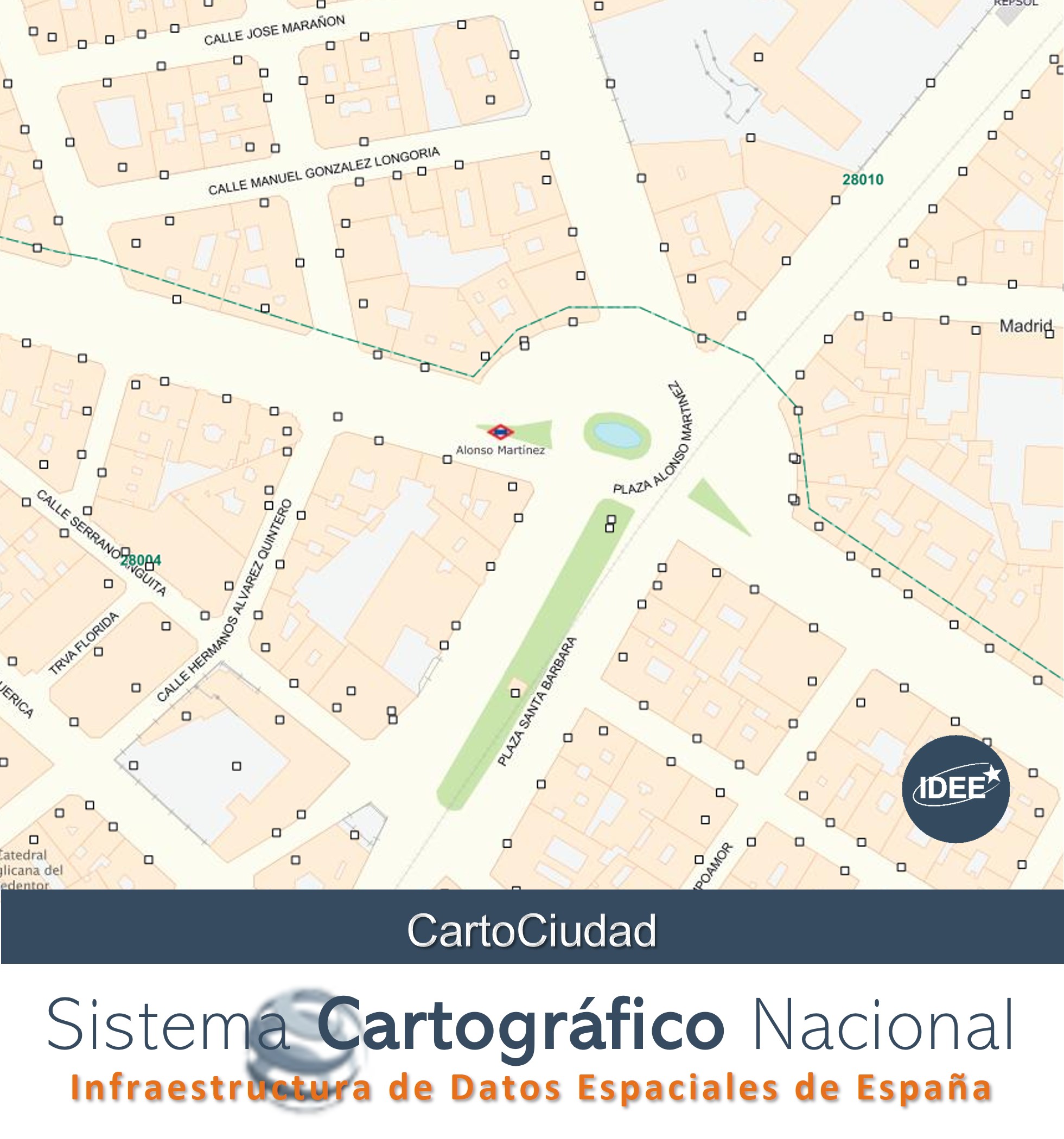
Postal addresses, kilometre points and place names in Spain (CartoCity)
CartoCiudad provides postal addresses, place names, population and administrative units of Spain, through web services, these data are complemented by the assignment of the postal code. The official sources are: Reference Geographic Information Transport Network (IGR-RT) of the National Cartographic System, Eusko Jaurlaritza - Basque Government, General Directorate of Cadastre, Government of Navarre, Andalusian Institute of Statistics and Cartography (CDAU), the Community of Madrid and the Government of La Rioja and, Barcelona Provincial Council, Cáceres City Council, Valencian Cartographic Institute (Generalitat Valenciana), Correos Group, National Geographic Institute, and National Institute of Statistics.
More information on the product at www.cartociudad.es/portal/.
Simple
- Alternate title
-
Cartociudad
- Date (Creation)
- 2006-12-31
- Citation identifier
- SCNE / cartociudad_addresses
- Citation identifier
- Cartociudad / AD_Address
- Citation identifier
- GrupoCorreos / codigo_postal
- Presentation form
- Digital map
- Purpose
-
The purpose of the digital cartography generated by the CartoCiudad project is its use as basic urban cartography and the possibility of carrying out the following consultation and navigation operations:
-Direct location of objects:
--Assigning coordinates to a postal address
--Assigning coordinates to a population
--Assign coordinates to a postcode
-Assigning coordinates to a point of interest (POI).
-Inverse location of objects:
-Assigning a postal address to a pair of coordinates
-Assigning a point of interest to a pair of coordinates
-Assign a population to a pair of coordinates.
-Calculate walking distances between two points.
-Calculate areas of proximity to a point.
-Calculate points of interest closest to a given direction.
-Calculate points of interest in the defined environment of a given position.
The aim of the CartoCiudad project is to have a database that is as complete and up-to-date as possible, so that the user can geolocate any property on Spanish territory with official information, and so that this information can also be used in the different services that CartoCiudad has, such as Web Feature Service, (WFS) and Web Map Service, (WMS) in accordance with the Network Services Regulations and the processing service (Web Processing Service, WPS) and the REST services: services and geocoder.
- Credit
-
Sistema Cartográfico Nacional http://www.scne.es/#IGR-RT
- Credit
-
Dirección General del Catastro
- Credit
-
Instituto Nacional de Estadística (INE)
- Credit
-
Grupo Correos
- Credit
-
Instituto Cartográfico Valenciano (Generalitat Valenciana)
- Credit
-
Gobierno de Navarra
- Credit
-
Eusko Jaurlaritza/Gobierno Vasco
- Credit
-
Gobienro de La Rioja
- Credit
-
Instituto de Estadística y Cartografía de Andalucía (CDAU)
- Credit
-
Comunidad de Madrid
- Credit
-
Diputació de Barcelona
- Credit
-
Ayuntamiento de Cáceres
- Credit
-
Centro Nacional de Información Geográfica
- Credit
-
Instituto Geográfico Nacional
- Point of contact
-
Organisation name Individual name Electronic mail address Role National Cartographic System
cartociudad@transportes.gob cartociudad@transportes.gob.es
Point of contact Centro Nacional de Información Geográfica (CNIG)
Publisher
- Maintenance and update frequency
- Monthly
- Update scope
- Dataset
- Maintenance note
-
Actualización trimestral
- Keywords
-
-
IGN
-
CNIG
-
España
-
Spain
-
D. G. Catastro
-
Código Postal
-
Callejero
-
Postal code
-
Thorughfare name
-
Administrative unit name
-
- Specific usage
-
Visualization of a street map, with utilities for searching addresses, place names, administrative units, postal codes, and calculation of minimum distances and areas of influence, through the CartoCiudad geoportal http://www.cartociudad.es or standard web services.
- User contact info
-
Organisation name Individual name Electronic mail address Role National Centre of Geographic Information (CNIG)
cartociudad@transportes.gob cartociudad@transportes.gob.es
Distributor
- Access constraints
- Other restrictions
- Other constraints
- Sin limitaciones al acceso público.
- Use constraints
- Other restrictions
- Other constraints
- No se aplican condiciones de acceso y uso.
- Other constraints
- CC BY 4.0 ign.es
- Other constraints
-
http://www.ign.es/resources/licencia/Condiciones_licenciaUso_IGN.pdf
- Spatial representation type
- Vector
- Denominator
- 500
- Denominator
- 1000
- Denominator
- 10000
- Language
- Spanish; Castilian
- Language
- Catalan; Valencian
- Language
- baq
- Language
- glg
- Character set
- UTF8
- Topic category
-
- Location
- Transportation
))
- Supplemental Information
-
https://centrodedescargas.cnig.es/CentroDescargas/documentos/Cartociudad_documentacion.zip
- Unique resource identifier
- ETRS89 coordenadas geográficas longitud y latitud.
- Distribution format
-
Name Version Geopackage (.gpkg) 2.0
gml+xml 4.0
geo+json a través de API Features 1.0.2
Distributor
- Distributor contact
-
Organisation name Individual name Electronic mail address Role Centro Nacional de Información Geográfica (CNIG)
Distributor
- Fees
-
Free download through the CNIG's download centre or through network services of INSPIRE Directive (WFS, ATOM Feed, API Features)
- Units of distribution
-
Geopackage of provinces and GML files for queries through Addresses WFS.
- OnLine resource
-
Protocol Linkage Name OGC Web Map Service https://www.cartociudad.es/wms-inspire/direcciones-ccpp?REQUEST=GetCapabilities&SERVICE=WMS&VERSION=1.3.0 View Services (WMS) for the Addresses
OGC Web Feature Service https://www.cartociudad.es/wfs-inspire/direcciones?request=GetCapabilities&service=WFS&VERSION=2.0.0 Download service (WFS) for the Addresses
http://www.cartociudad.es/geocoder/api/geocoder/candidatesJsonp? Geocoder Service Addresses, geographical names and POI of Spain (CartoCity)
https://centrodedescargas.cnig.es/CentroDescargas/buscadorCatalogo.do?codFamilia=02122 Download portal of CNIG
https://tms-ign-base.idee.es/1.0.0/IGNBaseTodo/{z}/{x}/{-y}.jpeg TMS service of Street map
https://tms-ign-base.idee.es/1.0.0/IGNBaseOrto/{z}/{x}/{-y}.png TMS service of Street map to orthoimagery
OGC API - Features - Part 1: Core https://api-features.idee.es/collections/address API for downloading Address of Cartociudad Project (API-Features)
- Hierarchy level
- Dataset
Conformance result
Conformance result
- Statement
-
CartoCiudad is a set of portal-type addresses and kilometre points over the entire national territory, generated from official data.
In general terms, the production processes carried out to obtain the CartoCiudad product are
- Extraction of data from the road network from the Transport Network Reference Geographic Information
- Calculation of the relationship between roads and municipalities (municipalities crossed by each road).
- Assignment, by geometric intersection, of population to the address (portal and kilometre point) and to place names.
- Assignment, by geometric intersection, of administrative unit to the address (portal and kilometre point) and to place names.
- Assignment, by geometric intersection, of postal code to the address (gate and kilometre point)and to place names.
- Incorporation of cadastral blocks
Process step
- Description
-
CartoCiudad publishes, through web services, the postal addresses of Spain with specific representation generated from the information of
1) The road network produced by the Reference Geographical Information Transport Network (IGR-RT), which is made up of interurban roads (motorways, dual carriageways, roads, tracks and paths) with their kilometre points and the portals located on the edge of the plot.
2) The addresses (street and number) of different bodies. To obtain national coverage, the addresses of the General Directorate of Cadastre, Eusko Jaurlaritza - Basque Government and Government of Navarre are taken. At regional level, these are complemented by the addresses of the Andalusian Institute of Statistics and Cartography (CDAU), the Community of Madrid and the Government of La Rioja and, at local level, by the addresses of the Barcelona Provincial Council and Cáceres City Council.
3) Postal codes from the Correos Group in order to establish a relationship with the addresses and population centres of the NGI. In addition, Correos Group provides the geometry, from which the postal code polygons are generated through the visualisation service. The postal codes are not available for download.
4) The official name and type of urban road from the National Institute of Statistics, which provides the official name and type of urban road (street, avenue, square, etc.), compiled from the data of the town councils. Every year it also provides the districts and census sections. These, like the postal codes, are visible and can be consulted through the WMS services but their geometries cannot be downloaded.
5) Boundary lines, towns and points of interest from the National Geographic Institute From the geocoding service, in addition to consulting the addresses, you can also consult the location and surface geometry of the municipalities, provinces and autonomous communities, points of interest from the multiscale three-dimensional database (1: 2,000-1: 25,000) with complete and continuous coverage for Spain, and the Basic Classification of Spain (NGBE), and towns.
This information is available to the public through the CNIG's Download Centre and is published through spatial data services for viewing (WMS), downloading (WFS) and REST services, open and free of charge, with national coverage under a CC BY 4.0 licence. This information is updated quarterly.
- Description
-
Urban cadastral cartography of the General Directorate of Cadastre
- MASA (Shapefile file): Polygons that delimit the blocks, with the alphanumeric information associated with these geometries.
- PLOT (Shapefile file): Polygons that delimit each of the cadastral plots, with the alphanumeric information associated with these geometries.
- CONSTRU (Shapefile file): Polygons that define the buildings and different land cover, etc.
- Description
-
Information from the National Statistics Institute (INE) used to generate the Reference Geographical Information of the NGI Transport Network: Street directory of roads in dbf file: Database table containing the official name of the road, INE road number, relations between identifiers Directorate General of Cadastre and the INE.
- Description
-
Postal codes of Group Correos
- Description
-
Direcciones de otros organismos oficiales (Comunidades Autónomas, Ayuntamientos), principalmente utilizadas para generar la red viaria, y, en el caso del País Vasco y Navarra, para incluir la información catastral y estadística.
Metadata
- File identifier
- spaign_cartociudad_addresses XML
- Metadata language
- Spanish; Castilian
- Character set
- UTF8
- Hierarchy level
- Dataset
- Date stamp
- 2024-06-06
- Metadata standard name
-
INSPIRE Regulation Nº1205/2008
- Metadata standard version
-
TG 2.0
- Metadata author
-
Organisation name Individual name Electronic mail address Role Spanish Spatial Data Infrastructure (IDEE)
ign@transportes.gob ign@transportes.gob.es
Point of contact
- Other language
-
Language Character encoding English UTF8
Overviews
Spatial extent
Provided by
