 INSPIRE Geoportal
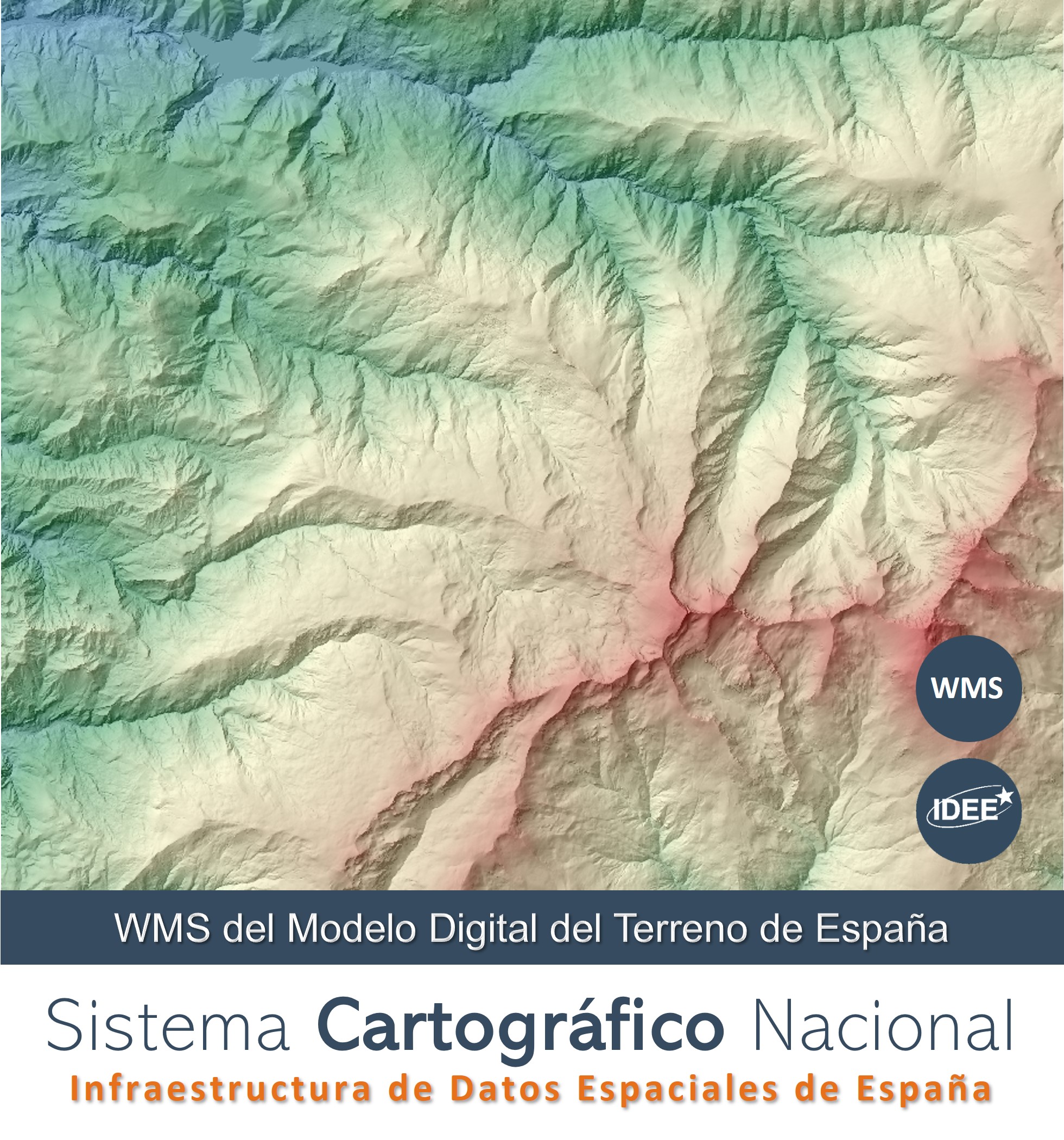
WMS del Modelo Digital de Terreno de España
Representación de los Modelos Digitales de Elevaciones de España: curvas de nivel y puntos acotados procedentes de BTN25, y Modelo Digital del Terreno de España 1ª Cobertura con paso de malla de 5 m, en diversos sistemas de referencia. Las capas pertenecen al Tema de Elevaciones del Anexo II de Inspire y del Anexo I de LISIGE. Sus denominaciones son conformes con la Directiva Inspire 2007/2/EC así como su estilo. Además tienen asociado un estilo de visualización definido por el IGN. Servicio de visualización WMS 1.3.0 conforme al perfil Inspire de ISO 19128:2005.
Simple
Identification info
- Date (Publication)
- 2013-02-01
- Point of contact
-
Organisation name Individual name Electronic mail address Role Infraestructura de Datos Espaciales de España (IDEE)
Point of contact
-
WebServicesSpecification
-
-
1.3.0
-
WMS
-
OGC
-
- Keywords
-
-
IDEE
-
Infraestructura de Datos Espaciales
-
Sistema Cartográfico Nacional
-
SCNE
-
Lidar
-
MDT
-
- Access constraints
- Other restrictions
- Other constraints
- Sin limitaciones al acceso público.
- Use constraints
- Other restrictions
- Other constraints
- CC BY 4.0 scne.es
- Other constraints
-
http://www.ign.es/resources/licencia/Condiciones_licenciaUso_IGN.pdf
- Service Type
- view
))
- Coupling Type
- Tight
- Contains Operations
-
Operation Name Distributed Computing Platforms Connect Point GetCapabilities
Web services https://servicios.idee.es/wms-inspire/mdt?REQUEST=GetCapabilities&Service=WMS&version=1.3.0 GetMap
Web services https://servicios.idee.es/wms-inspire/mdt GetFeatureInfo
Web services https://servicios.idee.es/wms-inspire/mdt
- OnLine resource
-
Protocol Linkage Name OGC Web Map Service https://servicios.idee.es/wms-inspire/mdt?REQUEST=GetCapabilities&SERVICE=WMS Servicio de visualización WMS del MDT
- Hierarchy level
- Service
- Other
-
Servicio web de datos espaciales. Servicio de visualización
Conformance result
Conformance result
Conformance result
Metadata
- File identifier
- spaignwms_mdt XML
- Metadata language
- Spanish; Castilian
- Hierarchy level
- Service
- Hierarchy level name
-
Servicio
- Date stamp
- 2022-05-18
- Metadata standard name
-
Reglamento (CE) Nº 1205/2008 de Inspire
- Metadata standard version
-
TG 2.0
- Metadata author
-
Organisation name Individual name Electronic mail address Role Infraestructura de Datos Espaciales de España (IDEE)
Point of contact
Overviews
Spatial extent
Provided by
