INSPIRE Geoportal
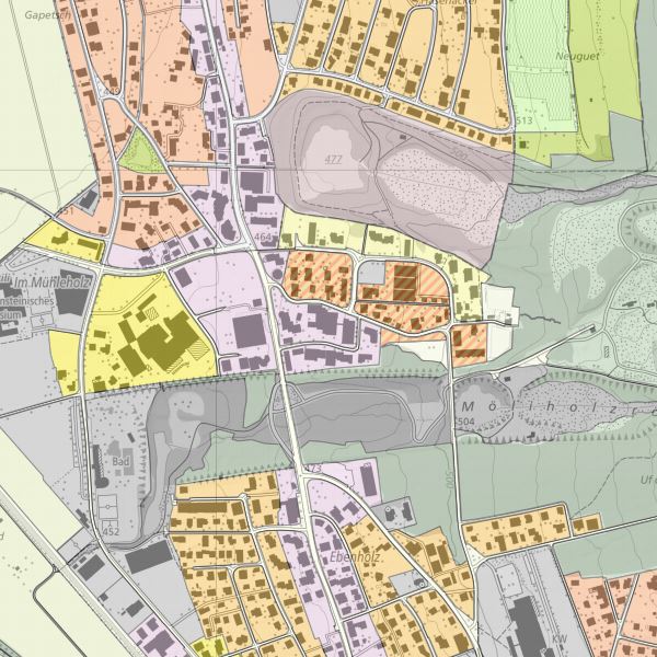
INSPIRE Planned Land Use
INSPIRE Planned Land Use
INSPIRE Konformer Datensatz planned land use abgeleitet aus dem Datensatz Nutzungsplanung
INSPIRE compliant dataset planned land use derived form landUse plans of the cummunities
Simple
-
AlternativtitelAlternate title
-
INSPIRE Thema planned land use
INSPIRE dataset planned land use
-
Date (Création)Data (Creazione)Date (Creation)Date (Creation)Datumsangaben (Erstellung)
- 2019-04-01T00:00:00
-
IdentificateurIdentificatoreCitation identifierCitation identifierIdentifikator
- https://metadata.geo.llv.li/6e0267a6-6160-49f6-9e2c-48a9a24b84c8
-
ZweckPurpose
-
Umsetzung INSPIRE
INSPIRE Implementation
-
EtatStatusStatusStatusBearbeitungsstatus
-
Mise à jour continueIn corsoOn goingOn goingKontinuierliche Aktualisierung
- Point of contact
-
Organisation name Individual name Electronic mail address Role Abt. Vermessung und Geoinformation (ATG)
Abt. Vermessung und Geoinformation (ATG)
Abt. Vermessung und Geoinformation (ATG)
Abt. Vermessung und Geoinformation (ATG)
Abt. Vermessung und Geoinformation (ATG)
Point de contactPunto di contattoPoint of contactPoint of contactAnsprechpartner
-
Fréquence de mise à jourFrequenza di aggiornamentoMaintenance and update frequencyMaintenance and update frequencyÜberarbeitungsintervall
-
Lorsque nécessaireSecondo necessitàAs neededAs neededBei Bedarf
-
GEMET
-
-
Bodennutzung
utilisation du sol
uso del suolo
soil use
-
Vektor
vecteur
vettore
vector
-
-
geocat.ch
-
-
INSPIRE
INSPIRE
INSPIRE
INSPIRE
-
-
GEMET - INSPIRE themes, version 1.0
-
-
Bodennutzung
Usage des sols
Utilizzo del territorio
Land use
-
-
GEMET themes
-
-
Forstwirtschaft
sylviculture
forestazione
forestry
-
Landwirtschaft
agriculture
agricoltura
agriculture
-
Bauwesen und gebaute Umwelt
bâtiment
edilizia
building
-
Verwaltung, Organisation, Institutionen, Planung, Politik und -vollzug, immaterielle Massnahmen
administration
amministrazione
administration
-
Tourismus und Freizeit
tourisme
turismo
tourism
-
-
Spatial scope
-
-
National
Nationales
Nazionali
National
-
-
Contraintes d'accèsVincoli di accessoAccess constraintsAccess constraintsZugriffseinschränkungen
-
Autres restrictionsAltri vincoliOther restrictionsOther restrictionsBenutzerdefinierte Einschränkungen
-
Andere Einschränkungen
-
no limitations to public access
-
Anwendungseinschränkungen
-
Zugangs- und Nutzungsbedingungen
-
Contraintes d'utilisationVincoli di fruibilitàUse constraintsUse constraintsNutzungseinschränkungen
-
Autres restrictionsAltri vincoliOther restrictionsOther restrictionsBenutzerdefinierte Einschränkungen
-
Andere EinschränkungenOther constraints
-
gebührenpflichtig
charges apply
-
Type de représentation spatialeTipo di rappresentazione spazialeSpatial representation typeSpatial representation typeRäumliche Darstellungsart
-
VecteurDati vettorialiVectorVectorVektor
-
Dénominateur de l'échelleDenominatoreDenominatorDenominatorMassstabszahl
- 500
-
Langue de la ressourceLingua dei datiLanguageLanguageSprache
- Deutsch
-
Encodage des caractèresSet dei caratteri dei datiCharacter setCharacter setZeichensatz
-
Utf8UTF8UTF8UTF8Utf8
-
Catégorie ISOTemaTopic categoryTopic categoryThematik
-
-
Carte de référence de la couverture terrestreMappe di baseImagery base maps earth coverImagery base maps earth coverOberflächenbeschreibung
-
Étendue
Estensione
Extent
Extent
Ausdehnung
-
BeschreibungDescriptionDescrizioneDescriptionDescription
-
Liechtenstein
Liechtenstein
Liechtenstein
Liechtenstein
Liechtenstein
))

-
Nom du système de référenceIdentificatore del sistema di riferimentoReference system identifierReference system identifierIdentifikator des Referenzsystems
-
http://www.opengis.net/def/crs/EPSG/0/21782
-
Nom du système de référenceIdentificatore del sistema di riferimentoReference system identifierReference system identifierIdentifikator des Referenzsystems
-
http://www.opengis.net/def/crs/EPSG/0/4258
-
Niveau topologieLivello di topologiaTopology levelTopology levelTopologielevel
-
Topologie de réseau complèteGrafo planare completoFull planar graphFull planar graphFlächen
-
Type de géométries des objetsOggetto di tipo geometricoGeometric object typeGeometric object typeGeometrietyp
-
PolygoneSuperficieSurfaceSurfaceFläche
-
Nombre d'objets géométriquesConteggio oggetto geometricoGeometric object countGeometric object countAnzahl
- 100
- Distribution format
-
Name Version Geographic Markup Language (GML)
ESRI Shapefile (SHP)
- Distributor contact
-
Organisation name Individual name Electronic mail address Role Abt. Vermessung und Geoinformation (ATG)
Abt. Vermessung und Geoinformation (ATG)
Abt. Vermessung und Geoinformation (ATG)
Abt. Vermessung und Geoinformation (ATG)
Abt. Vermessung und Geoinformation (ATG)
Point de contactPunto di contattoPoint of contactPoint of contactAnsprechpartner
- OnLine resource
-
Protocol Linkage Name WWW:LINK
https://geodaten.llv.li Geodatenportal der Liechtensteinische Landesverwaltung
Geoportal of the national administration
WWW:LINK
https://www.llv.li/de/landesverwaltung/amt-fuer-tiefbau-und-geoinformation/geodateninfrastruktur/datenausgabe Homepage ATG, Datenausgabestelle
Website ABI data distribution office
OGC Web Map Service
https://service.geo.llv.li/mapserver/INSPIRE?service=WMS&request=GetCapabilities LU
LU
LU
LU
LU
ATOM Syndication Format
https://service.geo.llv.li/atom/service.xml INSPIRE Download Service (ATOM)
INSPIRE Download Service (ATOM)
INSPIRE Download Service (ATOM)
INSPIRE Download Service (ATOM)
INSPIRE Download Service (ATOM)
-
NiveauLivelloHierarchy levelHierarchy levelBezugsebene
-
Jeu de donnéesDatasetDatasetDatasetDatenbestand
- Other
-
Alle Ebenen
Cohérence du domaine de valeurs
Consistenza di dominio
Domain consistency
Domain consistency
Konsistenz des Wertebereichs
Résultat de conformité
Conformità
Conformance result
Conformance result
Konformitätsergebnis
-
Date (Publication)Data (Pubblicazione)Date (Publication)Date (Publication)Datumsangaben (Publikation)
- 2010-12-08
- Explanation
-
nicht geprüft
-
Degré de conformitéPassPassPassBestanden
- No
Résultat de conformité
Conformità
Conformance result
Conformance result
Konformitätsergebnis
-
Date (Création)Data (Creazione)Date (Creation)Date (Creation)Datumsangaben (Erstellung)
- 2013-12-10
- Explanation
-
konform
-
Degré de conformitéPassPassPassBestanden
- Yes
-
ErläuterungStatement
-
Die Daten wurden aus dem Fachdatenmodellen auf die INSPIRE Struktur übersetzt
dataset was tranformed from national standard to a INSPIRE compliant dataset
-
SourceDati di origineSourceSourceDatenquelle
-
- Zonenplan der Gemeinde Balzers
- Zonenplan der Gemeinde Triesen
- Zonenplan der Gemeinde Eschen
- Zonenplan der Gemeinde Mauren
- Zonenplan der Gemeinde Vaduz
- Zonenplan der Gemeinde Schaan
- Zonenplan der Gemeinde Planken
- Zonenplan der Gemeinde Gamprin
- Zonenplan der Gemeinde Ruggell
- Zonenplan der Gemeinde Schellenberg
- Zonenpläne der Gemeinde Triesenberg
Metadata
-
Identifiant de la ficheIdentificatore del file di metadatiFile identifierFile identifierMetadatensatzidentifikator
- 6e0267a6-6160-49f6-9e2c-48a9a24b84c8 XML
-
LangueLingua dei metadatiMetadata languageMetadata languageSprache
- Deutsch
-
Jeu de caractèresSet dei caratteri dei metadatiCharacter setCharacter setZeichensatz
-
Utf8UTF8UTF8UTF8Utf8
-
Type de ressourceLivello gerarchicoHierarchy levelHierarchy levelHierarchieebene
-
Jeu de donnéesDatasetDatasetDatasetDatenbestand
-
Date des métadonnéesData dei metadatiDate stampDate stampDatum
- 2024-04-30T05:35:44.438Z
- Metadata standard name
-
GM03 2+
- Metadata author
-
Organisation name Individual name Electronic mail address Role Abt. Vermessung und Geoinformation (ATG)
Abt. Vermessung und Geoinformation (ATG)
Abt. Vermessung und Geoinformation (ATG)
Abt. Vermessung und Geoinformation (ATG)
Abt. Vermessung und Geoinformation (ATG)
Point de contactPunto di contattoPoint of contactPoint of contactAnsprechpartner
- Other language
-
Language Character encoding FrançaisFranceseFrenchFrenchFranzösischUtf8UTF8UTF8UTF8Utf8ItalienItalianoItalianItalianItalienischUtf8UTF8UTF8UTF8Utf8AnglaisIngleseEnglishEnglishEnglischUtf8UTF8UTF8UTF8Utf8RomancheRomancioRomanshRomanshRätoromanischUtf8UTF8UTF8UTF8Utf8AllemandTedescoGermanGermanDeutschUtf8UTF8UTF8UTF8Utf8