INSPIRE Geoportal
INSPIRE Download Service
Atom Feed basierter Download-Dienst für Daten gemäss den Anhangen I, II und III der Richtlinie Richtlinie 2007/2/EG des Europäischen Parlaments und des Rates vom 14. März 2007 zur Schaffung einer Geodateninfrastruktur in der Europäischen Gemeinschaft (INSPIRE)
Simple
Information de l'identification
Informazioni di identificazione
Identification info
Identification info
Basisinformation
-
Alternativtitel
-
INSPIRE Atom Feed Download Services Liechtenstein
-
Date (Publication)Data (Pubblicazione)Date (Publication)Date (Publication)Datumsangaben (Publikation)
- 2015-02-16
- Edition
-
Publikation
-
Date d'éditionData di edizioneEdition dateEdition dateAusgabedatum
- 2015-02-22
-
IdentificateurIdentificatoreCitation identifierCitation identifierIdentifikator
- https://metadata.geo.llv.li/9c0614f8-7268-48df-b702-24f7b2264b8c
- Cited responsible party
-
Organisation name Individual name Electronic mail address Role Abt. Vermessung und Geoinformation (ATG)
Abt. Vermessung und Geoinformation (ATG)
Abt. Vermessung und Geoinformation (ATG)
Abt. Vermessung und Geoinformation (ATG)
Abt. Vermessung und Geoinformation (ATG)
Point de contactPunto di contattoPoint of contactPoint of contactAnsprechpartner
-
Zweck
-
Umsetzung INSPIRE
- Point of contact
-
Organisation name Individual name Electronic mail address Role Abt. Vermessung und Geoinformation (ATG)
Abt. Vermessung und Geoinformation (ATG)
Abt. Vermessung und Geoinformation (ATG)
Abt. Vermessung und Geoinformation (ATG)
Abt. Vermessung und Geoinformation (ATG)
Point de contactPunto di contattoPoint of contactPoint of contactAnsprechpartner
-
Fréquence de mise à jourFrequenza di aggiornamentoMaintenance and update frequencyMaintenance and update frequencyÜberarbeitungsintervall
-
ContinueContinuoContinualContinualKontinuierlich
-
geocat.ch
-
-
INSPIRE
INSPIRE
INSPIRE
INSPIRE
-
Datendownload
téléchargement de données
download di dati
data download
-
-
INSPIRE Service taxonomy
-
-
infoFeatureAccessService
infoFeatureAccessService
infoFeatureAccessService
infoFeatureAccessService
-
infoFeatureTypeService
infoFeatureTypeService
infoFeatureTypeService
infoFeatureTypeService
-
-
GEMET - INSPIRE themes, version 1.0
-
-
Schutzgebiete
Sites protégés
Siti protetti
Protected sites
-
Bewirtschaftungsgebiete/Schutzgebiete/geregelte Gebiete und Berichterstattungseinheiten
Zones de gestion, de restriction ou de réglementation et unités de déclaration
Zone sottoposte a gestione/limitazioni/regolamentazione e unità con obbligo di comunicare dati
Area management/restriction/regulation zones and reporting units
-
Adressen
Adresses
Indirizzi
Addresses
-
Geografische Bezeichnungen
Dénominations géographiques
Nomi geografici
Geographical names
-
Flurstücke/Grundstücke (Katasterparzellen)
Parcelles cadastrales
Parcelle catastali
Cadastral parcels
-
-
GEMET themes
-
-
Bauwesen und gebaute Umwelt
bâtiment
edilizia
building
-
-
GEMET
-
-
Informationsdienst
service d'information
servizio informativo
information service
-
-
Spatial scope
-
-
National
Nationales
Nazionali
National
-
-
Contraintes d'accèsVincoli di accessoAccess constraintsAccess constraintsZugriffseinschränkungen
-
Autres restrictionsAltri vincoliOther restrictionsOther restrictionsBenutzerdefinierte Einschränkungen
-
Andere Einschränkungen
-
no limitations to public access
-
Anwendungseinschränkungen
-
Zugangs- und Nutzungsbedingungen
-
Contraintes d'utilisationVincoli di fruibilitàUse constraintsUse constraintsNutzungseinschränkungen
-
Autres restrictionsAltri vincoliOther restrictionsOther restrictionsBenutzerdefinierte Einschränkungen
-
Andere Einschränkungen
-
Lizenz
-
Type de serviceTipo di servizioService TypeService TypeArt des Dienstes
- download
- Service Version
-
1.0
Étendue
Estensione
Extent
Extent
Ausdehnung
-
BeschreibungDescriptionDescrizioneDescriptionDescription
-
Liechtenstein
Liechtenstein
Liechtenstein
Liechtenstein
Liechtenstein
))

- Coupled Resource
-
Operation Name Scoped name Identifier GetRecordById
50fb7bec-c4bd-4b71-a3f3-9b223ee998bb
GetRecordById
8c4b6669-8828-44b7-a888-fd43f9611893
GetRecordById
964fe1c4-f708-4f5b-b628-26b656adb9eb
GetRecordById
c851eb68-629c-4f96-a177-8c3e45b3b62c
GetCapabilities
INSPIRE Download Service 2e72850d-6e4f-47e2-90e8-984704996136
GetCapabilities
3ec74dd2-3db0-49c8-8a48-f99ad0f5ab4d
GetCapabilities
b57f591d-ee98-45dd-b3ab-6969e5868ff1
GetCapabilities
a1591fa2-2e87-4b50-8eb5-7343680a4808
GetCapabilities
ce516af7-4bc8-4ab9-bad0-8c9289abfbe4
GetCapabilities
cfd9bb7f-61a3-4ef7-a8f2-63b4b1187564
GetCapabilities
5249bc4c-5f58-45d7-aa5d-a274a63bdce9
GetCapabilities
6e0267a6-6160-49f6-9e2c-48a9a24b84c8
GetCapabilities
966fc243-08b9-4f4f-a38d-6bd1d5079fa6
-
Type de couplageTipo di accoppiamentoCoupling TypeCoupling TypeArt der Kopplung
-
LibreLooseLooseLooseLose
- Contains Operations
-
Operation Name Distributed Computing Platforms Connect Point GetRecordById
WebServicesServizi WebWeb servicesWeb servicesWebServiceshttp://www.geocat.ch/geonetwork/srv/ger/csw-liechtenstein?
-
Ressource coupléeLavora suOperates OnOperates OnBezieht sich auf
-
- INSPIRE Datensatz Flurstuecke/Grundstuecke (Katasterparzellen)
- INSPIRE Datensatz Geografische Bezeichnungen
- INSPIRE Datensatz Adminstrative Units
- INSPIRE Protected Sites
- INSPIRE LandCover
- INSPIRE Buildings
- INSPIRE Statistical Units - NUTS regions Liechtenstein
- INSPIRE Statistical Units - ETRS-LEA
- INSPIRE Datensatz Physical Water
- Arealstatistik Fürstentum Liechtenstein 2019
- INSPIRE Datensatz Hydrography -Netzwerk
- INSPIRE Planned Land Use
- INSPIRE Transport Network
-
Nom du système de référenceIdentificatore del sistema di riferimentoReference system identifierReference system identifierIdentifikator des Referenzsystems
-
http://www.opengis.net/def/crs/EPSG/0/4258http://www.opengis.net/def/crs/EPSG/0/4258http://www.opengis.net/def/crs/EPSG/0/4258http://www.opengis.net/def/crs/EPSG/0/4258http://www.opengis.net/def/crs/EPSG/0/4258
- Distribution format
-
Name Version Geographic Markup Language (GML)
- Distributor contact
-
Organisation name Individual name Electronic mail address Role Abt. Vermessung und Geoinformation (ATG)
Abt. Vermessung und Geoinformation (ATG)
Abt. Vermessung und Geoinformation (ATG)
Abt. Vermessung und Geoinformation (ATG)
Abt. Vermessung und Geoinformation (ATG)
Point de contactPunto di contattoPoint of contactPoint of contactAnsprechpartner
- OnLine resource
-
Protocol Linkage Name WWW:LINK
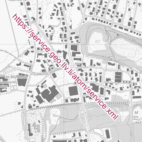
https://service.geo.llv.li/atom/service.xml
-
NiveauLivelloHierarchy levelHierarchy levelBezugsebene
-
ServiceServiceServiceServiceService
- Other
-
Services
Résultat de conformité
Conformità
Conformance result
Conformance result
Konformitätsergebnis
-
Date (Publication)Data (Pubblicazione)Date (Publication)Date (Publication)Datumsangaben (Publikation)
- 2010-12-08
- Explanation
-
nicht geprüft
-
Degré de conformitéPassPassPassBestanden
- Yes
-
Erläuterung
-
INSPIRE ATOM Generator
Metadata
-
Identifiant de la ficheIdentificatore del file di metadatiFile identifierFile identifierMetadatensatzidentifikator
- 9c0614f8-7268-48df-b702-24f7b2264b8c XML
-
LangueLingua dei metadatiMetadata languageMetadata languageSprache
- Deutsch
-
Jeu de caractèresSet dei caratteri dei metadatiCharacter setCharacter setZeichensatz
-
Utf8UTF8UTF8UTF8Utf8
-
Type de ressourceLivello gerarchicoHierarchy levelHierarchy levelHierarchieebene
-
ServiceServiceServiceServiceService
- Hierarchy level name
-
Service
-
Date des métadonnéesData dei metadatiDate stampDate stampDatum
- 2024-04-30T15:00:25.999Z
- Metadata standard name
-
GM03 2+
- Metadata standard version
-
1.0
- Metadata author
-
Organisation name Individual name Electronic mail address Role Abt. Vermessung und Geoinformation (ATG)
Abt. Vermessung und Geoinformation (ATG)
Abt. Vermessung und Geoinformation (ATG)
Abt. Vermessung und Geoinformation (ATG)
Abt. Vermessung und Geoinformation (ATG)
Point de contactPunto di contattoPoint of contactPoint of contactAnsprechpartner
- Other language
-
Language Character encoding FrançaisFranceseFrenchFrenchFranzösischUtf8UTF8UTF8UTF8Utf8ItalienItalianoItalianItalianItalienischUtf8UTF8UTF8UTF8Utf8AnglaisIngleseEnglishEnglishEnglischUtf8UTF8UTF8UTF8Utf8RomancheRomancioRomanshRomanshRätoromanischUtf8UTF8UTF8UTF8Utf8AllemandTedescoGermanGermanDeutschUtf8UTF8UTF8UTF8Utf8